Why Iceland makes new land and loses old soil
3 243 words · 15 min · updated 2026-09-10
 Back to Iceland
Iceland is being made and unmade at the same time. New crust arrives along the Mid-Atlantic Ridge, which crosses the island from southwest to northeast and pulls it apart at some 19 millimetres a year. Icelandic volcanoes have produced a third of the total global lava output over the past 500 years, and set against that, 39% of the country is subject to considerable or extensive soil erosion and the birch wood that covered between 30 and 40% of the island before it was settled survives in a few stands.
In short
- Area
- 103,004 km², about 2.7% water
- Coastline
- 4,970 km, deeply indented by fjords
- Highest point
- Hvannadalshnúkur, 2,110 m
- Glacier cover
- 10.2% of the land
- Active volcanic systems
- about 30, of hundreds of volcanoes
- Plate spreading
- some 19 mm a year
- Highlands
- about half the land area, all but uninhabited
- Exclusive economic zone
- 751,345 km²
How a mid-ocean ridge came up for air
The Mid-Atlantic Ridge is the seam where the North American and Eurasian plates pull away from each other, and along almost the whole of its length it lies under deep water. Iceland is the stretch of it that stands in the air, the one large insular landmass in the world sitting on a mid-ocean ridge above sea level. A mantle plume sits beneath the ridge here and has supplied enough magma to stack the sea floor above the surface, and the plates on either side of the rift go on separating at some 19 millimetres a year. That makes the ground new. The oldest rocks on the island formed about 16 million years ago and the island as a whole is dated at 16 to 18 million years, which is the age of a landform and not of a continent. What is visible is the surface expression of the Iceland Plateau, a large igneous province built by the plume and the ridge together, crossed from southwest to northeast by the rift zones where both are still working. The rock is overwhelmingly one rock. Of the surface area of everything erupted since the last ice age, 92% is basalt, 4% basaltic andesite, 1% andesite and 3% dacite and rhyolite. Basalt builds a particular kind of country: plateaus with successive lava layers showing one above another on the valley sides, sheets that tilt gently towards the centre of the island, and edges cut into fjords where those sheets meet the sea.
Iceland is largely a tableland broken up by structural faults. The average elevation is 500 metres and a quarter of the country lies below 198 metres, so the high ground is a raised interior with a low rim around it. The highest point, Hvannadalshnúkur at 2,110 metres, is a point on the rim of Öræfajökull, a volcano at the southern edge of the Vatnajökull ice cap, and the lowest point is the sea.
Where the rift reaches the surface it can be walked along. At Þingvellir, 49 kilometres east of Reykjavík, a rift valley of fissures and cliffs cuts through grass-covered lava fields with Lake Þingvallavatn at its southern end, and it is the clearest place on earth to look at two plates moving apart. The cliffs there are commonly described as the facing edges of two continents. They are in fact the junction of the North American plate and a smaller plate of about 10,000 square kilometres called the Hreppar microplate.
What the volcanic systems keep making
The country carries hundreds of volcanoes and about 30 active volcanic systems, a count some classifications put at 34, which is the figure used in Iceland itself. Thirteen of those systems had erupted since the settlement of AD 874, counted up to 2008. Over the past 500 years Icelandic volcanoes have produced a third of the total global lava output, and current productivity, which is known to be cyclical, is estimated at 0.05 to 0.08 cubic kilometres a year. Cooled lava covers roughly a tenth of the country's area, which is about the share the glaciers hold.
Occasionally the process makes ground where there was none. Surtsey rose out of the sea off the southwest coast in a series of eruptions between 8 November 1963 and 5 June 1968, and only scientists researching how life arrives on new land are allowed to visit it.
Most Icelandic eruptions are effusive, which follows from the basalt: fissure vents open along the swarms and pour lava out in volume without throwing much of it into the air. The Holuhraun eruption that began on 17 August 2014 and ended on 27 February 2015 ran for 180 days, delivered between 250 and 350 cubic metres of lava a second from a dyke over 40 kilometres long, and left an ice-filled subsidence bowl over 100 square kilometres in area and up to 65 metres deep. Its ash output was very limited; what travelled was sulphur dioxide, which affected breathing conditions across the country according to the wind.
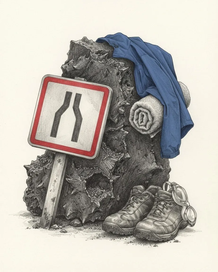
Icelandic has two words for what the lava leaves behind, and the difference decides what the ground is afterwards. Helluhraun is the smooth, corded, ropy surface that can be walked across. Apalhraun is the loose, broken, spiny kind, where it is easy to put a foot into a hole and break a leg.
| Eruption | Date | What it did |
|---|---|---|
| Laki, the Skaftáreldar | 1783 to 1784 | Roughly a fifth of the population died, most of them from ash, poisonous gases and disease in livestock |
| Surtsey | 8 November 1963 to 5 June 1968 | Built a new island off the southwest coast, closed to all but researchers |
| Eldfell, on Heimaey | January 1973 | About 5,300 people evacuated on fishing boats within hours; one death; seawater sprayed on the lava to save the harbour |
| Eyjafjallajökull | April 2010 | About 20 countries closed their airspace, affecting roughly 10 million travellers |
| Holuhraun | 17 August 2014 to 27 February 2015 | 180 days of fissure eruption, the largest in Iceland for 230 years |
| Fagradalsfjall | 19 March 2021 | A 200 metre fissure on the Reykjanes peninsula, 500 metres long within hours |
| Sundhnúkur, near Grindavík | from 18 December 2023 | Lava destroyed three houses in the town in January 2024 |
The seismic side of it is constant and mostly harmless. During a single week in February 2021 around 17,000 earthquakes hit the southwestern region of Reykjanes, and earthquakes in Iceland are frequent but rarely do serious damage, in part because buildings put up since the middle of the twentieth century are reinforced concrete designed to take severe shocks. What the eruptions did to the people living among them is the subject of Iceland: history.
Why the interior of the island is empty
The Highlands take up about half the land area and hold almost nobody. They are a mountainous lava desert of recent volcanic origin, mostly uninhabited and uninhabitable. Tundra covers 62.7% of the country, lakes and glaciers 14.3% of its surface, and only 23% of it carries vegetation at all. Arable land was 1.21% of the territory as measured in 2012.
Settlement is a rim around that emptiness. The inhabited areas are on the coast, most of them in the southwest, and more than 70% of the population lives in the southwest corner, Greater Reykjavík together with the nearby Southern Peninsula, which covers less than 2% of the land area. The largest town outside that corner is Akureyri in the north. About 20% of the land is used for grazing and about 1% is cultivated.
The transport network has the same shape as the settlement. Route 1, the Ring Road, was completed in 1974 and runs 1,332 kilometres around the island with one lane in each direction and about 30 single-lane bridges, most of them in the southeast. Of 13,034 kilometres of administered roads, 4,617 are paved, and no passenger railway has ever operated in the country.
Traditionally Iceland has been divided according to the four points of the compass, and the eight regions in use, the Capital Region, the Southern Peninsula, West, Westfjords, Northwest, Northeast, East and South, sit on much the same divisions. Each makes a different living from the ground it has. The southwest has harbours and fishing and almost no farmland, because lava fields and heaths take up the surface. The western fjords have sheltered harbours and very little lowland suitable for agriculture. The north is a set of smaller districts, each with relatively good farmland. The southeast is locked between the glaciers and the sea. The southern lowland is the main farming region, with the soil, the climate and the shortest road to the largest market.
What the ice still does to the land
Glaciers cover 10.2% of the total land area and are retreating at an accelerating rate. Vatnajökull accounts for 7,764 square kilometres of that and is about 900 metres thick at its thickest point, and the ice cap alone runs to some 780,000 hectares. The World Heritage property around it takes in over 1,400,000 hectares, roughly 12% of the country, about 85% of it classified as wilderness.
| Glacier | Area |
|---|---|
| Vatnajökull | 7,764 km² |
| Langjökull | 868 km² |
| Hofsjökull | 827 km² |
| Mýrdalsjökull | 542 km² |
| Drangajökull | 145 km² |
| Eyjafjallajökull | 70 km² |
Ice cut the shape of the coast and most of the relief below the plateaus. The U-shaped valleys are largely the result of glacial erosion, and because that erosion deepened the inner ends of the fjords, the fjords are fine natural harbours, which is why the fishing towns stand where they do. Where no glacial river reaches the sea the coast runs regular and sandy, lined with offshore sandbars closing lagoons behind them.
Ice and magma meet here more often than they meet elsewhere, and the meeting has produced landforms of its own. Eight of the ten central volcanoes inside the Vatnajökull property are subglacial. Tuyas, and the ridges called tindar, built of brown hyaloclastite in fissure eruptions beneath ice age glaciers, occur nowhere else in the world in such numbers. Geothermal heat and subglacial eruptions produce meltwater and the outburst floods called jökulhlaups, which sweep out and maintain the sandur plains north and south of the ice cap and cut canyons quickly. Volcanism, earthquakes, avalanches and glacial lake outburst flooding are the four natural hazards the country lists for itself.
The ice is going. Vatnajökull reached its greatest extent by the end of the eighteenth century and has been retreating on average since then, with the retreat accelerating recently in response to global warming. The consequences run well past the ice: the melting of Iceland's glaciers on its own could raise sea levels by about one centimetre, and in late 2025 the country elevated a possible collapse of the Atlantic Meridional Overturning Circulation to a national security risk, on the reasoning that the circulation keeping its coasts habitable is the same one that could stop.
Where the water runs and stands
Rivers here come in two kinds. Glacial rivers are debris-laden, braided and grey, running out of the ice caps and across outwash plains they rebuild every season. The others are clear streams fed by rainfall and by springs of underground water, and they run steadily where the glacial rivers surge. The longest is Þjórsá at 230 kilometres. Waterfalls are common, which is what a geologically young mountain relief and heavy rainfall produce between them, and Glymur in Hvalfjörður is the second tallest.
The lakes are mostly accidents of lava and ice, many of them dammed by lava flows or by glacial ice. Þórisvatn, a reservoir, covers 83 to 88 square kilometres and Þingvallavatn covers 82, Jökulsárlón is the deepest at 248 metres, and Lagarfljót and Mývatn are the other two of consequence. Total renewable water resources were put at 170 cubic kilometres in 2011, against a freshwater withdrawal of 0.17 cubic kilometres a year.
Hot water is a resource on the same scale as the cold. Alkaline hot springs are found in some 250 areas across the country, and the largest of them, Deildartunguhver in Borgarfjörður, emits nearly 190 litres of boiling water a second. Torfajökull, the largest of the 19 high-temperature solfatara regions, has an estimated total power output of about 1,000 megawatts. Geysir gave English the word geyser; it went quiet, began erupting again after a series of earthquakes in 2000, and has since grown quieter, while Strokkur beside it erupts every 8 to 10 minutes.
Four natural resources are listed for Iceland, and two of them are this water: marine life, diatomite, hydropower and geothermal power. Geothermal and hydroelectric plants supply effectively all of the country's electricity and around 85% of its total primary energy consumption, the remainder being mostly imported oil for transport and for the fishing fleet. Cheap heat and cheap electricity are a geographical accident before they are an industrial policy, and what has been built on them is the subject of Iceland: economy.
Why the weather is milder than the latitude
The country lies between 63 and 68 degrees north, and the main island sits entirely south of the Arctic Circle, which passes instead through the small island of Grímsey off the northern coast. On latitude alone the coasts should freeze. They stay ice-free through the winter because a branch of the Gulf Stream flows along the southern and western coasts and the warm North Atlantic Current holds annual temperatures above what this latitude would otherwise give, and the last ice incursion on the north coast was in 1969.
The position that makes the country mild also makes it unsettled. Iceland sits on a broad boundary between air of polar origin and air of tropical origin, and the contact between mild Atlantic air and colder Arctic air produces the frequent changes of weather and the storminess the Icelandic Meteorological Office treats as the defining feature of the climate. The same contact puts more rain on the south and west of the island than on the north. The East Greenland Current, meeting the Gulf Stream here, sometimes carries Arctic drift ice to the northern and eastern shores.
| Nearest land | Distance |
|---|---|
| Greenland, across the Denmark Strait | about 320 km |
| Faroe Islands | 420 km |
| Jan Mayen | 570 km |
| Shetland and the Outer Hebrides | about 740 km |
| Scottish mainland and Orkney | about 750 km |
| Mainland Norway | about 970 km |
| Mainland North America, at Labrador | 2,070 km |
The averages are unremarkable and the spread is not. Reykjavík has a mean annual temperature of 4 °C, a mean January temperature of minus 0.5 °C and a mean July temperature of 11 °C, and the city averages nearly 1,300 hours of bright sunshine a year. Precipitation is where the country divides: from about 410 millimetres a year on some high northern plateaus to more than 4,100 millimetres on the southern slopes of some ice-capped mountains, with the south averaging around 2,000. Snow falls on about 100 days a year in the northwest and about 40 in the southeast. Gales are frequent in winter and thunderstorms are rare.
The records sit at the edges of the country and a lifetime apart. The highest air temperature recorded is 30.5 °C, at Teigarhorn on the southeastern coast on 22 June 1939, and the lowest is minus 38 °C, at Grímsstaðir and Möðrudalur in the northeastern hinterland on 22 January 1918. Within the island the south is warmer, wetter and windier than the north, the Central Highlands are the coldest part of the country, and the low-lying inland areas of the north are the driest.
What settlement took off the ground
The island that was settled was wooded. Fossilised tree pollen and the descriptions left by the first settlers put tree cover at between 30 and 40% of the island before people arrived, almost all of it northern birch, and Ari the Wise wrote in the Íslendingabók in the late twelfth century that the country had been forested from mountain to sea shore.
The soil underneath was thin. The mineral soils are a yellow-brown loess formed by deposits of wind-transported matter, and biological activity is slow in this climate, so they rebuild slowly and they move easily. Cutting the birch for firewood and timber, grazing imported sheep on what was left, and the climatic deterioration of the Little Ice Age took the cover off between them, and once the cover was off the wind and the water had the topsoil. The measurements are unambiguous. Three-quarters of Iceland's 100,000 square kilometres is affected by soil erosion, and 18,000 square kilometres is affected seriously enough to make the land useless. A soil erosion survey spanning 25 to 30 years found 39% of the country subject to considerable or extensive erosion, and a recent survey found 45% of land ecosystems in bad condition.
Repair has been state work for more than a century. The Soil Conservation Service of Iceland was founded as a state agency in 1907 and works with farmers, farmer groups and local governments on revegetation and ecosystem restoration: seeding grasses to halt erosion, adding fertiliser to increase vegetation cover, and more recently restoring wetlands. New revegetation and restoration projects cover around 8,000 hectares a year. Iceland has been a party to the United Nations Convention to Combat Desertification since 1997 and hosts the United Nations Land Restoration Training Programme, which is an unusual role for a wet subarctic island and follows directly from the state of its ground.
Forestry is the other half of the repair. A reforestation programme instituted by the government in the 1950s began to show considerable success from the mid-1970s, and forest cover has increased sixfold since the 1990s. The tallest tree in the country, a sitka spruce planted at Kirkjubæjarklaustur in 1949, measured 25.2 metres in 2013. The largest surviving native birch woods are Hallormsstaðaskógur and Vaglaskógur, and much of the new planting uses introduced species, so what is growing back is a different forest from the one that was cut. How the cutting happened is told in Iceland: history.
What lives on ground this young
The whole country is a single ecoregion, the Iceland boreal birch forests and alpine tundra, and its land fauna is short because everything in it had to cross an ocean. The Arctic fox was the only land mammal present when people arrived, having walked over the frozen sea at the end of the last ice age. There are no native reptiles and no native amphibians. About 1,300 species of insect are known here, against more than a million described worldwide, and the island was essentially free of mosquitoes until October 2025.
Almost everything else on land was brought or escaped. Icelandic sheep, cattle, the Icelandic horse and the Icelandic sheepdog descend from animals imported by settlers, reindeer were introduced later and are still found in the northeastern highlands, and mink brought in for fur production after 1930 went wild. Polar bears arrive occasionally on icebergs from Greenland, two of them in June 2008, and no Icelandic population exists.
What the land could not provide, the sea did. The exclusive economic zone runs to 751,345 square kilometres against a total land area of 103,004, and the fishing banks off the shores are abundantly endowed with fish, although those stocks have been considerably eroded by overexploitation. Seabirds are the other dense population: Atlantic puffins, skuas and black-legged kittiwakes nest on the sea cliffs, and salmon and trout are abundant in the lakes, brooks and rivers. Life has also got into the places that look uninhabitable. The volcanic zones hold endemic groundwater fauna that survived the ice age, and single-celled organisms prosper in the subglacial lakes beneath Vatnajökull, in conditions that may replicate those of the early Earth and of the icy satellites of Jupiter and Saturn. Three national parks, Vatnajökull, Snæfellsjökull and Þingvellir, protect the largest pieces of all this, and what a visitor can reach of it is covered in Iceland: travel.
Surroundings
Which countries border Iceland
Recorded as shared borders, which includes neighbours across water: Iceland has a coast, and the list reads accordingly. Hover a row to find the country on the map; the distance is capital to capital, in a straight line.
 Faroe IslandsSouth-eastTórshavn797 km
 GreenlandNorth-westNuuk1,431 km
Common questions
Questions about Iceland
How big is Iceland?
103,004 square kilometres, about 2.7% of it water, with a coastline of 4,970 kilometres and an exclusive economic zone of 751,345 square kilometres. The highest point is Hvannadalshnúkur at 2,110 metres, on the rim of the Öræfajökull volcano at the southern edge of the Vatnajökull ice cap.
Why is Iceland so volcanic?
The island sits on the Mid-Atlantic Ridge and over a mantle plume at the same time, which is why a mid-ocean ridge stands above sea level here. There are hundreds of volcanoes and about 30 active volcanic systems, thirteen of which had erupted since the settlement of AD 874 as counted up to 2008, and over the past 500 years Icelandic volcanoes have produced a third of the total global lava output.
How cold is Iceland?
Less cold than the latitude suggests, because a branch of the Gulf Stream runs along the southern and western coasts. Reykjavík has a mean annual temperature of 4 °C, a January mean of minus 0.5 °C and a July mean of 11 °C. The highest temperature on record is 30.5 °C at Teigarhorn on 22 June 1939, and the lowest is minus 38 °C at Grímsstaðir and Möðrudalur on 22 January 1918.
How much of Iceland is under ice?
Glaciers cover 10.2% of the land area and are retreating at an accelerating rate. Vatnajökull accounts for 7,764 square kilometres of that and is about 900 metres thick at its thickest point; it reached its greatest extent by the end of the eighteenth century and has been shrinking on average since.
Where do people live in Iceland?
On the coast, and mostly in one corner of it. More than 70% of the population lives in the southwest, in Greater Reykjavík and the nearby Southern Peninsula, which together cover less than 2% of the land area, while the Highlands take up about half the country and are all but uninhabited.