Cyprus's geography: an island made of raised seafloor
3 210 words · 15 min · updated 2026-09-10
 Back to Cyprus
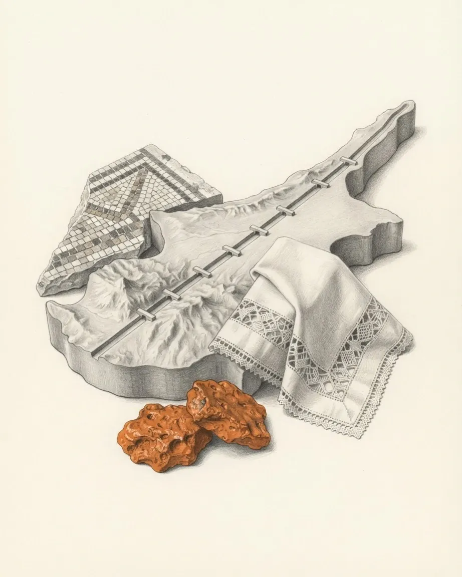
Rock at the summit of Mount Olympus formed about 92 million years ago several kilometres below the floor of an ocean that no longer exists, and it now stands 1,951 metres above the Mediterranean. The Troodos Ophiolite Complex covers 3,200 square kilometres of an island of 9,251, and geologists rate it, alongside the ophiolite of Oman, as the most complete and best exposed section of oceanic crust and upper mantle anywhere on land. Where the copper lies, where the rain falls, where the springs rise and where the villages were built all follow from that one slab of raised seafloor.
In short
- Area
- 9,251 km², of which 9,241 is land and 10 inland water
- Highest point
- Mount Olympus, 1,951 m, in the Troodos
- Northern range
- Pentadaktylos, rising to 1,024 m at Mount Selvili
- Coastline
- 648 km, and no land border at all
- Exclusive economic zone
- 98,707 km², more than ten times the land
- Troodos ophiolite
- 3,200 km² of ocean floor formed 92 million years ago
- Rainfall
- About 500 mm a year, 350 mm at Nicosia, 1,050 mm on Mount Olympus
- Water storage
- 108 dams and reservoirs, about 330 million m³
Why the highest ground was once the deepest
The rock exposed around the summit of Mount Olympus is harzburgite, the residue left in the upper mantle after part of it melted, with bodies of dunite inside it. The Geological Survey Department of Cyprus dates the Troodos Ophiolite Complex to the Upper Cretaceous, about 92 million years ago, and places its formation along a short segment of a seafloor spreading axis in the Neotethys Ocean, above a zone where the African plate was descending beneath the Eurasian one. That ocean ran from the Pyrenees through the Alps, the Pindos and the Zagros to the Himalayas. The Mediterranean is the remnant of it.
What makes the complex a reference case for geologists worldwide is that every layer of an oceanic crust is present, in order, and exposed. Along with the ophiolite of Oman it is considered the most stratigraphically complete, best exposed and best preserved sequence of its kind on land, and it has drawn geoscientists to the island since the 1960s, when plate tectonics was accepted and the rocks acquired an explanation.
| Unit | What it was before it became a mountain |
|---|---|
| Umbers and radiolarites | mud of iron and manganese dropped by hot springs on the ocean floor |
| Pillow lavas | basalt chilled into spheres 30 to 170 cm across on contact with seawater |
| Sheeted dykes | the near-vertical channels that fed those lavas, in places 100% dyke |
| Gabbro, wehrlite, dunite | crystals settled on the floor of a magma chamber 4 to 6 km below the seabed |
| Harzburgite | upper mantle left over after the basalt melt was drawn off |
The sequence appears on the ground upside down. The lowest units of the ophiolite outcrop around the highest peak, and the progressively younger ones appear in rings towards the flanks of the range, an inversion produced by the rise of the core as a dome and by the differing rates at which the various rocks weather. The Arakapas valley, running east to west across the southern side of the massif, is read as a fossilised transform fault, the kind of offset that breaks a spreading ridge on any ocean floor. What lifted all of it was the convergence of the African and Eurasian plates, and the last stage was abrupt: Troodos and the northern range both rose sharply about two million years ago.
One consequence of the lifting is written into the rock itself. Seawater circulating through harzburgite and dunite at temperatures below 500 degrees Celsius turned much of the olivine in them into serpentine minerals, among them chrysotile, which grows as fibres across the veins it fills. The term ophiolite was coined in the early nineteenth century from the Greek words for snake and rock, because serpentinite resembles green snakeskin. Ancient writers, for unrelated reasons, called the island Ophiussa, the abode of snakes.
How separate blocks of rock became one island
Cyprus is assembled from four geological zones, and only one of them is the ophiolite. The others are the Pentadaktylos range along the north coast, the Mamonia rocks of the Paphos district, and the sedimentary cover that fills the middle of the island. Two of the four arrived from somewhere else.
Where the northern range came from
The Pentadaktylos, called the Kyrenia range in Greek usage, is a narrow limestone ridge that rises out of the plain and runs for about 160 kilometres just inland from the northern shore. Its elevations run from 200 metres to 1,024 at Mount Selvili, roughly half the height of the Troodos dome, and it is built of deformed Mesozoic limestone rather than igneous rock. It is the southernmost range of the Alpine and Himalayan chain in the eastern Mediterranean. Those hard limestones were thrust over much softer material, the marls and cherts of the Lapithos Formation and the Kythrea flysch, a stack of clays, marls and sandstones some 3,000 metres thick, and by shielding that material from erosion they left the ridge standing above it.
Lawrence Durrell, in Bitter Lemons, set the two ranges against each other: the Troodos as an unlovely jumble of crags and heavyweight rocks, the Kyrenia range as belonging to the world of Gothic Europe, its lofty crags studded with crusader castles. The eastern end of the ridge falls away into the foothills of the Karpas peninsula, which points at Asia Minor, the landmass Cyprus belongs to geologically. The island sits on the Anatolian plate. Its political geography puts it in Europe and it joined the European Union on 1 May 2004, while several sources place it in Western Asia and within the Levant.
The Mamonia rocks are the other arrivals. They range in age from the Triassic to the Upper Cretaceous, formed in areas south of the present island, and were emplaced where they now sit about 70 million years ago as Africa collided with Eurasia. They include sandstones and radiolarites, pillow lavas, recrystallised limestones and metamorphic rocks such as amphibolite and phyllite, and the coloured grits used by the mosaicists at Kourion and Paphos were quarried from them. They also slide: the landslides recorded in the Paphos district occur in Mamonia sediments and in the bentonitic clays of the Kannaviou Formation.
How the Mesaoria plain came to be flat
Everything between the two ranges was laid down in water on top of the Troodos lavas. Umbers and radiolarites came first, then the bentonitic clays of the Kannaviou Formation, then the deep-water marls, chalks and cherts of the Lefkara Formation between 67 and 22 million years ago. As Troodos rose the sea over it grew shallower, and the Pakhna Formation of chalks, marls, sandstones and limestones records that shallowing between 22 and 7 million years ago. Between 6 and 5.33 million years ago the Strait of Gibraltar closed, the Mediterranean was cut off from the Atlantic, and the Messinian Salinity Crisis left beds of gypsum and halite. The strait reopened, the sea returned, and the marls and calcarenites of the Nicosia Formation were deposited until about two million years ago.
Then came the abrupt uplift, and with it erosion on a scale that stripped sand and gravel off both ranges and dumped it across the middle of the island as the Apalos Formation and its fanglomerates. Those clastic beds are thickest at the eastern and western ends of the plain, where they hold the largest aquifers on Cyprus. The aquifers were found after the Second World War, and drilling into them turned the Morphou and Famagusta areas into citrus country.
Between them lies the Mesaoria, whose name means between the mountains, a flat, low corridor open to the sea at Morphou Bay in the west and Famagusta Bay in the east, with Nicosia sitting in the middle of it. Its vertisols are the most productive soils on the island and it is the principal cereal ground, though the wheat and barley depend almost entirely on how much rain falls in winter.
Why Cyprus and copper carry the same name
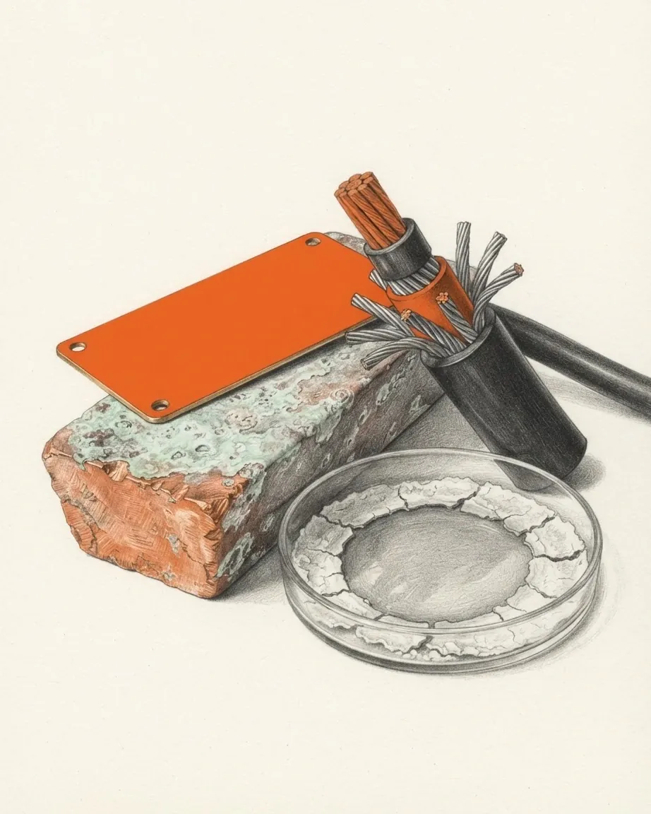
The massive sulphide bodies of Troodos formed at the same spreading centre that produced the lavas, mostly within the Lower Pillow Lavas, and they came up with everything else during the Pleistocene. Cyprus ranks among the five richest regions in the world in copper. The same complex holds the largest chrysotile asbestos deposit in Europe, chromite of metallurgical and refractory quality in the dunite bodies near Agios Nikolaos tis Kakopetrias, and the earth pigments umber, ochre, sienna and terra verde.
The metal took the island's name rather than the reverse. Trade carried it into Latin as aes Cyprium, metal of Cyprus, shortened to cuprum. The origin of the island's own name is unknown, and the candidates include the Greek words for the cypress and for the henna tree as well as an Eteocypriot word for copper that has been traced to Sumerian roots.
Mining began by 2500 BC and ran for three thousand years. More than a hundred ancient slag heaps survive, along with galleries, miners' tools and shipwrecks carrying copper ingots. Smelting on that scale consumed forest: the Geological Survey Department puts the energy required by the ancient copper industry at the equivalent of 150,000 square kilometres of pine forest, sixteen times the area of the island, and notes that the vegetation recovered anyway, on soils that renew quickly and under rainfall the mountains themselves generate. The modern industry is a shadow of it. The mines reopened shortly before the First World War, worked from 1925 until the Great Depression closed them, restarted after 1945, and the richest of them, at Skouriotissa, has lain in the Turkish-occupied zone since 1974, with ore reserves substantially reduced.
How the Troodos makes the island's rain
Cyprus sits in a semi-arid region and the Troodos is what saves it. The range lifts annual rainfall on its own high ground to about 1,000 millimetres, against an island average near 500, and holds snow from December to March with several weeks of nights below freezing. The lowest average of the settled areas is at Nicosia, in the rain shadow at the centre of the plain, and the highest is on Mount Olympus.
| Place | Average annual rainfall | Summer daytime | Winter |
|---|---|---|---|
| Nicosia, on the plain | 350 mm | average maximum 37 °C | 15 °C by day, 5 °C at night |
| Mount Olympus, Troodos | 1,050 mm | around 24 °C in July and August | snow, and nights below freezing |
| The coast | about 500 mm island-wide | around 30 °C, moderated by sea breeze | around 24 °C by day, 14 at night as an annual average |
Height governs the variation and distance from the sea governs the rest. The Mesaoria, cut off from the summer breezes and from most of the sea's humidity, has recorded peaks of 40 to 45 degrees Celsius, and midday humidity there falls to between 15 and 30% in summer. On the north side of the island the Kyrenia ridge blocks air currents coming from the south west, so both rain and humidity fall away on its eastern flank. Rain arrives between November and March, with three winter months carrying about 60% of the annual total in the north, and the eight-month summer that follows is close to rainless. Sunshine on the coast runs to about 3,200 hours a year, roughly twice the figure for London.
Why every river on the island runs dry
Every river of any size rises in the Troodos and runs off it in all directions. The Pedieos, the longest, crosses the Mesaoria eastward to Famagusta Bay, as does the Yialias. The Serakhis flows north west through the Morphou plain and the Karyotis north to Morphou Bay, while the Kouris drops south to Episkopi Bay. All of them are fed by winter runoff alone, and all of them are dry courses by summer. The old explanation for the island's water difficulties is deforestation wrecking the drainage through erosion; Grove and Rackham dispute that reading.
Water instead comes out of the rock. The uplift of Troodos fractured it, the fractures let rain percolate to depth along joints and faults, and the aquifers that resulted discharge at springs at many different altitudes. Those springs decided where villages went, in antiquity and since. The northern range works the same way through different chemistry: rainwater dissolves the limestone at depth into karst systems, the impermeable flysch beneath holds the water laterally, and the surplus emerges where limestone meets flysch, at Kythrea, Lapithos, Dikomo, Karava, Akanthou and Larnaka tis Lapithou. Roman engineers carried the Kythrea spring's water to Salamis.
What the island cannot do is hold winter rain in a natural basin, because it has no natural reservoir catchments. Cyprus has built 108 dams and reservoirs with a combined capacity of about 330 million cubic metres, and desalination has supplied close to half of domestic water since 2001. Total renewable water resources stood at 0.78 cubic kilometres in 2011 and withdrawal at 0.18 cubic kilometres a year, of which 86% went to agriculture; irrigated land covered 457.9 square kilometres in 2007. Seawater has intruded into the largest aquifer on the island and salination has increased in the north, which now also draws on a pipeline laid by Turkey under the sea from Anamur to the northern coast.
What lives on an island this isolated
The island carries 142 endemic species, and more than a third of them grow in the Troodos above 1,000 metres, where the soils are unusual and the summit zone behaves almost like a semi-alpine one. The golden oak, the Cyprus cedar and the Cypriot mouse are among the plants and animals found nowhere else. Woodland covers about 12% of the island, in pine, cedar, cypress and oak on the two ranges and locally lower down; ancient authors describe a far more forested island, including the Mesaoria, whose timber went into the fleets of successive conquerors. Where forest has gone, tall maquis is scarce, and most untilled ground carries grazed garrigue of low bushes, thinning under heavy grazing to a batha of thyme and thorny burnet.
The mammal record is what an island produces when it is left alone. Before people reached Cyprus, around 11,000 to 10,000 BC, four terrestrial mammals lived there: the Cypriot pygmy hippopotamus, the Cyprus dwarf elephant, the Cypriot genet and the Cypriot mouse. The first two had shrunk far below the size of their mainland ancestors through insular dwarfism, and the last record of the extinct endemics dates to shortly after human settlement. Their fossils turn up in the Kyrenia area. The largest wild animal left is the agrino, a wild sheep related to the mouflon of the western Mediterranean, protected in a small forested part of the Troodos.
The coast and the air above it carry more life than the interior. Green and loggerhead turtles nest on beaches around the island, hundreds of them on the northern shore, and their young hatch at the end of summer. Millions of migrating birds cross Cyprus in spring and autumn and many species winter there, alongside residents such as francolin and chukar partridge. Northern Cyprus alone records about 1,900 plant species, 19 of them endemic to the north and 30 of them orchids endemic to the island, and about a thousand wild donkeys range over 300 square kilometres of the Karpas peninsula.
How a ceasefire line became a landscape
The line that divides Cyprus is a physical feature with its own ecology. The buffer zone runs about 180 kilometres across the island, narrowing to a few metres in old Nicosia and widening to a few kilometres elsewhere, and its northern and southern limits are where the two sides stood when the ceasefire took effect on 16 August 1974, as recorded by the United Nations force.
| Segment | Share of the island |
|---|---|
| Republic of Cyprus | 59.74% |
| Turkish Republic of Northern Cyprus | 34.85%, or 3,355 km² |
| United Nations buffer zone | 2.67% |
| Akrotiri and Dhekelia, under British sovereignty | 2.74%, or 254 km² |
Parts of the zone are farmed and lived in. More than 10,000 people live or work inside the Civil Use Areas, which civilians may enter freely, while movement elsewhere in the zone needs authorisation from the peacekeeping force. Pyla is the one village in which Greek Cypriots and Turkish Cypriots live side by side. Other stretches have been left to themselves since 1974, with old villages and shops standing in them, and the near absence of hunters has made the zone a refuge for wildlife. Crossing points have opened since April 2003, at Ledra Street and elsewhere in Nicosia, at Astromeritis and Zodhia on the road towards the Troodos, at Pyrgos Limnitis and Yesilirmak in the west, and at Dherynia and Lefka in November 2018. The zone is interrupted in the east by the British base at Dhekelia, where the United Nations does not operate, and by Varosha, held by the Turkish military.
The line also cut the island's economic geography apart. The events of 1974 removed 70% of the wealth-producing resources of Cyprus from the republic's control, including 56% of mining and quarrying output and the port of Famagusta, which had handled 83% of general cargo; Nicosia International Airport was left inside the buffer zone and has been closed since. Dhekelia contains four Cypriot exclaves, the villages of Ormidhia and Xylotymvou and the two parts of the Dhekelia power station, one of which sits by the sea and has no territorial waters of its own because the water belongs to the United Kingdom. The buffer zone, running up against the base and resuming east of it, leaves the Paralimni area on the south-eastern corner as an exclave in practice.
What the sea around Cyprus is worth
There is no land border anywhere on the island: land boundaries measure zero kilometres and the coastline 648. The land covers 9,241 square kilometres and inland water 10, for a total of 9,251, in a shape 240 kilometres long and 100 kilometres across at its widest, which Britannica compares to a saucepan with the handle running north east. Everything beyond the shore is negotiated rather than inherited. The territorial sea extends 12 nautical miles, the continental shelf claim runs to a depth of 200 metres or to the depth of exploitation, and the exclusive economic zone covers 98,707 square kilometres, more than ten times the land.
The neighbours are close enough to matter and far enough apart to require agreement. Turkey lies 75 kilometres north, Lebanon 105 and Syria 108 to the north east, Israel 200 to the south east, Egypt 380 to the south, and Greece is furthest of all, 280 kilometres to Kastellorizo, 400 to Rhodes and 800 to the mainland. Cyprus demarcated its maritime boundary with Egypt in 2003, with Lebanon in 2007 and with Israel in 2010, and Turkey recognises none of those agreements. The Aphrodite gas field, in exploratory block 12 about 175 kilometres south of Limassol, sits inside the zone those agreements define.
The sea also sets the terms of the coast. Open-sea temperatures stay above 22 degrees Celsius from June to November and reach 27 in August, falling to 16 or 17 in the three coolest months, which is why the beaches work for as long as they do; a 2020 study by KPMG ranked Cyprus first in the world for Blue Flag beaches per kilometre of coastline. The same coast is the exposed edge. The European Environment Agency puts total damage from weather and climate extremes in Cyprus between 1980 and 2023 at 441 million euros, of which insurance covered 2%, and projects annual losses from rising sea levels of up to 0.4% of gross domestic product by 2050, a figure that coastal protection and planning could cut by as much as 90%.
Surroundings
Which countries border Cyprus
Recorded as shared borders, which includes neighbours across water: Cyprus has a coast, and the list reads accordingly. Hover a row to find the country on the map; the distance is capital to capital, in a straight line.
 United KingdomNorth-westLondon3,218 km
 IsraelSouth-eastJerusalem415 km
 TürkiyeNorth-eastAnkara532 km
Common questions
Questions about Cyprus
Which peak tops Cyprus?
Mount Olympus, also called Khionistra or Mount Troodos, at the centre of the Troodos range. The Geological Survey Department of Cyprus and Britannica both give its height as 1,951 metres; other sources round it to 1,952. It carries snow from December to March. The highest ground in the northern range is Mount Selvili in the Pentadaktylos at 1,024 metres, a little over half as high, and the lowest point of the country is the Mediterranean at sea level.
How large is Cyprus, and does it border any country?
The island covers 9,251 square kilometres, 9,241 of it land and 10 inland water, and measures 240 kilometres from end to end and 100 kilometres at its widest. It covers 9,251 square kilometres, which puts it behind Sicily and Sardinia among Mediterranean islands. Its land boundaries measure zero kilometres. The coastline runs 648 kilometres and the exclusive economic zone covers 98,707 square kilometres, with maritime boundaries agreed with Egypt in 2003, Lebanon in 2007 and Israel in 2010.
Are there any permanent rivers in Cyprus?
No. Every river of consequence rises in the Troodos and flows outward from it, the Pedieos and the Yialias east to Famagusta Bay, the Serakhis north west through the Morphou plain, the Karyotis north to Morphou Bay and the Kouris south to Episkopi Bay, and all of them are fed only by winter runoff. By summer they are dry courses. The island has no natural reservoir catchments, so it stores water behind 108 dams holding about 330 million cubic metres, and desalination has supplied close to half of domestic water since 2001.
Is Cyprus in Europe or in Asia?
Both answers have a basis. Geologically the island sits on the Anatolian plate and belongs to Asia Minor, which the Karpas peninsula points towards, and some sources place it in Western Asia and within the Levant. Politically it is treated as European: it joined the European Union on 1 May 2004 and it is the union's south-easternmost member. The Kyrenia and Troodos ranges run parallel to the Taurus Mountains on the Turkish mainland, which are visible from the northern coast.
Why do geologists come to the Troodos?
Because the Troodos Ophiolite Complex is a fragment of oceanic crust and upper mantle that has been lifted onto land with its layers intact and exposed, from mantle harzburgite through cumulate gabbros and a sheeted dyke complex to pillow lavas and the chemical sediments laid on top of them. It formed about 92 million years ago at a seafloor spreading axis in the Neotethys Ocean and is rated, with the ophiolite of Oman, the most stratigraphically complete and best preserved sequence of its kind in the world. Interest in it grew from the 1960s, when plate tectonics supplied the explanation.