Nicaragua's geography: a lake that drains to the farther sea
2 880 words · 13 min · updated 2026-10-04
 Back to Nicaragua
From the south-western edge of Lago de Nicaragua it is only 19 kilometres to the Pacific, and the lake empties into the Caribbean instead, down the Río San Juan along a passage close to sea level that crosses the whole isthmus. The divide between the two oceans' waters stands that close to the western coast. The central highlands drain mainly east, the two great lakes drain east through the San Juan, and the Pacific receives only short, steep streams. What lies east is a hot, wet Caribbean plain covering more than half the territory on leached soils, while most Nicaraguans live in the narrow volcanic west the rivers leave behind.
In short
- Area
- 130,370 km² in total, 119,990 km² of it land (Wikipedia); 130,373 km² (Britannica)
- Highest point
- Mogotón, 2,103 m (Britannica) or 2,085 m (Wikipedia), Cordillera Entre Ríos
- Lake Nicaragua
- 8,157 km², about 160 by 75 km, drained by the Río San Juan
- Lake to Pacific
- 19 km from the south-western edge of the lake
- Río San Juan
- 200 km from Lake Nicaragua to the Caribbean
- Caribbean lowlands
- More than half the territory, on leached soils
- Pacific volcanoes
- 40 in Britannica's count, 21 active under 2021 monitoring
- Tree cover lost
- 2,001,073 ha from 2001 to 2024, about 25.7% of the 2000 extent
Why Lake Nicaragua drains to the Caribbean
A long, narrow depression runs south-east across the isthmus from the Golfo de Fonseca to the Río San Juan. It follows a large crustal fracture, and the line of young volcanoes on the Pacific side stands just west of it. This rift holds the two lakes around which the west of the country is arranged. Lago de Managua is 56 kilometres long and 24 wide. Lago de Nicaragua, also called Cocibolca, is about 160 kilometres long and 75 wide. Britannica gives the larger lake an area of 8,157 square kilometres and Lake Managua 1,035.
Water moves through the pair in one direction. The Río Tipitapa carries Lago de Managua south into Lago de Nicaragua, and Lago de Nicaragua empties into the Río San Juan, which Britannica measures at 200 kilometres from the lake to the Caribbean. For much of that length the San Juan is the boundary with Costa Rica. Its valley is a natural passage close to sea level from the Caribbean to the lake and the rift beyond.
The Pacific is much nearer. The Wikipedia article on the country's geography gives 19 kilometres from the south-west edge of the lake to the ocean; the main Wikipedia article on Nicaragua puts the shore within 24 kilometres of it. Between the two stands a narrow line of ash-covered hills and volcanoes, highest in its central portion near León and Managua.
The highlands behind the lakes repeat the pattern at a larger scale. The central mountains form the main watershed, and their deep valleys drain primarily toward the Caribbean. Very few significant streams flow west to the Pacific, and those that do are steep, short and intermittent. Britannica names the Negro and the Estero Real, which empty into the Gulf of Fonseca, and the Tamarindo, which reaches the Pacific directly, and says all of them carry a small volume of water. Of the water that flows west from the mountains, whatever enters the lakes leaves through the San Juan for the Caribbean.
The lakes are big enough to change what the country's area means. The Wikipedia geography article gives a total of 130,370 square kilometres, of which 119,990 is land, so about 10,380 square kilometres of the total is water. Britannica's total is 130,373 square kilometres.
How the transit route used the rift
The low passage was a working route long before any canal was drawn on it. Granada, founded on Lake Nicaragua in 1524, traded with Spain by way of the San Juan, according to Britannica. After the California Gold Rush began in 1848, travellers between the eastern United States and California crossed by sea through Nicaragua.
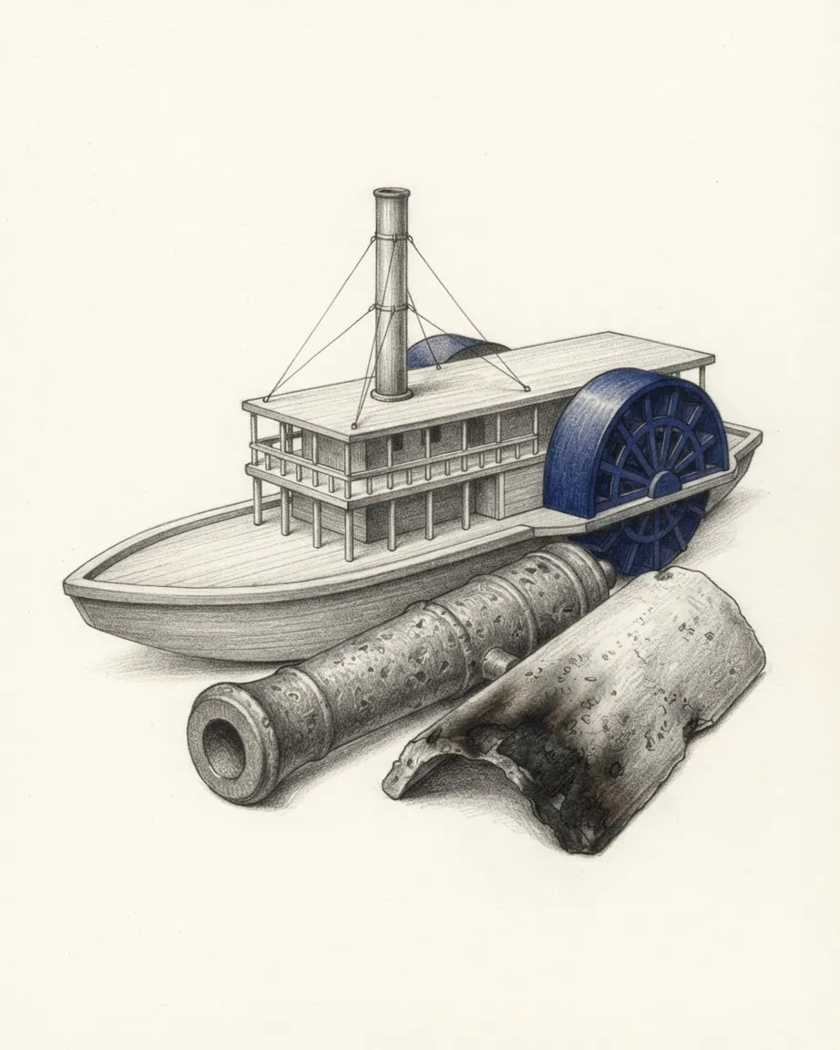
In 1851 Cornelius Vanderbilt set up the Accessory Transit Company to carry them. Its riverboats ran from the Atlantic port of Greytown up the San Juan to Lago de Nicaragua, and from the lake's western shore a twelve-mile carriage road descended to the Pacific port of San Juan del Sur. An essay published by the Gilder Lehrman Institute of American History says the company carried tens of thousands of passengers a year. Greytown was San Juan del Norte, the small Caribbean port that British officials seized and renamed in 1848. The twelve miles of road come to about 19 kilometres, the same gap the geography article measures.
Because the route was mostly water, whoever held the river held the crossing. When William Walker's filibusters took power in the 1850s, they depended on the transit steamers for reinforcements. In the campaign Costa Rican historians call the Campaign of the Transit, fought in 1857, Costa Rica's army took control of the San Juan and cut Walker off from the Caribbean.
The same geography drew a century and a half of canal schemes. The lake and the San Juan were often proposed in the 19th century as the longest part of a canal across the isthmus. Britannica records that José Santos Zelaya refused the United States canal rights on concessionary terms, which encouraged the United States to choose Panama. In December 2014 ground was broken on a canal promoted by the Chinese businessman Wang Jing, slated to run roughly three times the length of the Panama Canal. The Guardian described it in 2024 as a US$50 billion, 278-kilometre project that would have bisected Lake Nicaragua and displaced an estimated 120,000 people, including Rama and Creole communities on the Caribbean coast. Digging the waterway never started, and Nicaragua cancelled the concession in 2024.
The river is also a border in dispute. The main Wikipedia article on Nicaragua records a boundary dispute with Costa Rica involving the San Juan, and a separate dispute with Colombia over the Archipelago de San Andrés y Providencia and the Quita Sueño Bank. This catalogue records that both disputes exist and takes no position on either.
Where the volcanic chain stands along the Pacific
Britannica counts a string of 40 volcanoes, some of them active, running north-west to south-east along the Pacific coast and divided into two groups, the Cordillera de los Marrabios in the north and the Pueblos Mesas in the south. Other counts use other definitions. The Wikipedia article on tourism describes 18 distinct volcanic centres in the Nicaraguan portion of the Central American Volcanic Belt, and a monitoring programme launched on 9 June 2021 covers 21 active volcanoes. The tallest Britannica lists are San Cristóbal at 1,780 metres, Concepción at 1,610 and Momotombo at 1,280.
Which lakes and islands the volcanoes made
The volcanoes run straight through the water. Britannica describes Lake Nicaragua as bisected by a chain of volcanoes that has formed numerous islands, and the largest of them, Ometepe, is a single island built by two volcanoes, Concepción and Maderas. Near Granada the Isletas de Granada, an archipelago the Wikipedia article on tourism counts at 365 islands, formed when Mombacho blew most of its cone into the lake.
Smaller lakes fill old craters. The Apoyo Lagoon occupies a crater about 7 kilometres wide left by an eruption about 23,000 years ago. Britannica lists six freshwater lakes near Managua, among them Lake Asososca, the city's reservoir of drinking water, the slightly alkaline Lake Jiloá and Lake Tiscapa inside the capital itself, with Lake Apoyeque set between two peaks on Chiltepe Point.
The ash is why the west is farmed. On the Pacific side the soil is volcanic and about four-fifths of its area is fertile, according to Britannica. The plains around the lakes and north-west along the rift to the Gulf of Fonseca are enriched with ash, densely populated and well cultivated. Their natural vegetation is dry forest, and much of it has been converted to farmland or pasture.
How earthquakes moved León and Managua
Western Nicaragua lies where two tectonic plates collide, the Cocos Plate and the Caribbean Plate, and the Wikipedia geography article records hundreds of shocks each year. Eruptions have damaged crops with fumes and ash; earthquakes have done far more harm to life and property.
León was moved once already. UNESCO's World Heritage listing for the Ruins of León Viejo records a city founded in 1524 by Francisco Hernández de Córdoba near the western end of Lake Managua, partially destroyed by an eruption of Momotombo in 1578 and finished off by the earthquake of 1610, after which it was rebuilt six leagues away. The main Wikipedia article attributes the 1610 destruction to an eruption of Momotombo. The abandoned city was gradually buried, and its ruins were discovered in 1967.
Managua was virtually destroyed in 1931 and again in 1972. The death toll of the earthquake of 23 December 1972 differs by source. Britannica gives 6,000 dead and 300,000 homeless; the Wikipedia history of Nicaragua gives more than 10,000 dead and 500,000 homeless, and the main article says nearly 90% of the city was destroyed.
How high the northern highlands rise
North and east of the Pacific lowlands lies a triangle of rugged mountains. Its ridges run 900 to 1,800 metres high, covered in mixed oak and pine forest and separated by deep valleys. Britannica names the ranges as the Cordillera Entre Ríos on the Honduran border, the Cordilleras Isabelia and Dariense in the north-central area, and the Huapí, Amerrique and Yolaina mountains in the south-east. The mountains are highest in the north.
The highest point is Mogotón, in the Cordillera Entre Ríos, and its height depends on the source. Britannica gives 2,103 metres. The Wikipedia geography article gives 2,085.
The two sides of the highlands are settled differently. The western slopes are relatively dry, sheltered by the ridges from the moist Caribbean winds, and they have drawn farmers from the Pacific region since colonial times. The eastern slopes carry montane rain forest and are lightly populated by pioneer farmers and small Indigenous communities.
Elevation sets the climate here. Most of the highlands fall in the tierra templada, which the Wikipedia geography article places between 750 and 1,600 metres, with mild days of 24 to 27 °C and nights of 15 to 21 °C. Above 1,600 metres the tierra fría is found only on and near the highest peaks, with nights below 15 °C. The main Wikipedia article sets the temperate band lower, at 610 to 1,524 metres. Britannica puts the average temperature in the northern mountains at about 18 °C.
The main article says about a quarter of the country's agriculture takes place in this region, with coffee grown on the higher slopes, and that the rainy season is longer and wetter than on the Pacific side, which makes erosion a problem on the steep ground. The cloud forests hold oaks, pines, moss, ferns and orchids, and resplendent quetzals among their birds. One of the highland rivers now powers the west: the artificial Lake Apanás on the Tuma River generates much of the electricity consumed in the Pacific zone.
What covers the Caribbean plain
East of the highlands the land falls to low, level plains that Britannica says average about 100 kilometres in width. This is the Costa de Mosquitos, the Miskito Coast, and it takes up more than half of the national territory: more than 50% in the Wikipedia geography article and 57% in the main article. The former department of Zelaya, now the North and South Caribbean Coast Autonomous Regions, alone makes up about 45%.
The plain is hot and humid, and its soil is generally leached and infertile. Pine and palm savannas line the coast as far south as the Laguna de Perlas. South of the lagoon tropical rain forest runs past the San Juan into Costa Rica, and another belt of moist forest lies between the savannas and the highlands and follows the rivers through the savannas. Fertile soils occur only along the natural levees and narrow floodplains of the rivers.
Those rivers are long. Britannica measures them as follows.
| River | Length | Where it reaches the sea |
|---|---|---|
| Coco | 780 km, 475 km of it along the Honduran border | the Caribbean, on the extreme northern coast |
| Río Grande de Matagalpa | 430 km | the Caribbean, north of the Laguna de Perlas |
| Prinzapolka | 254 km | the Caribbean |
| San Juan | 200 km | the Caribbean, at the Costa Rican border |
| Indio | 97 km | the Caribbean |
| Escondido | 89 km | the Caribbean |
| Maíz | 60 km | the Caribbean |
The coast they reach has little in common with the Pacific one. The Caribbean coastline is far more sinuous than its generally straight Pacific counterpart, broken by river mouths, deltas and large lagoons, and offshore the continental shelf carries coral reefs, islands, cays and banks. The Corn Islands lie about 70 kilometres off the coast near Bluefields, and the easternmost point of the country is in the Miskito Cays.
Settlement here is thin, and it is moving. Bluefields and Puerto Cabezas, also called Bilwi, are the largest towns on the coast. In the second half of the 20th century many people from the west moved into the eastern region to farm, raise cattle or cut timber, according to Britannica. Inland in the north, the municipalities of Siuna, Rosita and Bonanza form what is called the Mining Triangle, where Bonanza still has an active gold mine and panning for gold is common.
Why the east takes the rain and the storms
Temperature varies little with the seasons and depends mostly on elevation. In the tierra caliente, from sea level to about 750 metres, days average 30 to 33 °C and nights fall to 21 to 24 °C for most of the year. Britannica puts the annual average at about 27 °C on both coasts.
Rain is where the two sides part. The Caribbean lowlands receive between 2,500 and 6,500 millimetres a year in the Wikipedia geography article, against 1,000 to 1,500 millimetres in the rift valley and on the western slopes of the highlands, which the ridges shelter from the moist Caribbean trade winds. Britannica's averages are 1,905 millimetres on the Pacific side and almost 3,810 on the Caribbean side. The Pacific side has a rainy season from May to November and a dry season from December to April, by Britannica's account; the Caribbean side has a rainy season of about nine months and a dry season from March through May.
In the rainy season the upper and middle reaches of the eastern rivers flood. Near the coast, where the banks and levees are low, floodwater spills over the floodplains until large parts of the lowlands become continuous sheets of water. Tropical storms and hurricanes strike the coast particularly from July through October, and from November through March the rains called papagayo storms can sweep south over both halves of the country, the rift valley in particular.
The record of storms is long. Hurricane Joan in 1988 forced hundreds of thousands of Nicaraguans from their homes and caused more than US$1 billion in damage, most of it along the Caribbean coast, and with a drought in 1989 it cut the harvest of basic grains. Hurricane Mitch followed at the end of October 1998, Hurricane Felix, a category 5 storm, in 2007, and Hurricane Nate in 2017. In November 2020 Eta and Iota made landfall in nearly the same places in consecutive weeks. The World Bank's emergency response to those two storms concentrated on housing, rural roads and artisanal fisheries.
The BTI 2026 country report cites the UNDP's finding that Nicaragua is highly vulnerable to climate change through floods, landslides, droughts, tides and hurricanes, and says extreme weather has fallen hardest on ethnic minorities on the Caribbean coast. It also reports national budget allocations to environmental agencies at less than 1% of total state spending.
How much eastern forest Nicaragua still has
Britannica says forest covers more than a third of the country and yields cedar, mahogany and pine. Global Forest Watch, as summarised in the Wikipedia geography article, measured 7,773,867 hectares of tree cover above 30% density in 2000 and a cumulative loss of 2,001,073 hectares from 2001 to 2024, about 25.7% of the 2000 area. The dataset does not count regrowth.
The eastern rain forest is largely protected by two reserves at either end of the Caribbean side. Bosawás in the north-east became a UNESCO biosphere reserve in 1997, and UNESCO's record gives it 1,994,187 hectares and a population of 466,310. The main Wikipedia article gives Bosawás 7,300 square kilometres, a figure under two fifths of UNESCO's. UNESCO cites estimates that 13% of the world's known species occur in the reserve, six kinds of forest, and a 2011 MARENA study finding the core forests in an excellent state, surrounded by areas already intervened. The Indio Maíz Biological Reserve protects the rain forest in the south.
On 24 July 2024 the environment ministry, MARENA, and the governments of the two Caribbean autonomous regions approved a project document to put to the Global Environment Facility for funding, to protect the forests of both reserves. It covers 997,337 hectares of land at a cost of US$34,757,456, with 8,491 beneficiaries in the two regions. The BTI 2026 report describes the setting for that work differently: it records the closure of environmental organisations including the Fundación del Río and the Centro Alexander von Humboldt, and calls MARENA, the National Forestry Institute and the National Water Authority ineffective.
The lakes keep their own fauna. The bull shark, which can survive in fresh water for long periods, lives in Lake Nicaragua and the San Juan and is locally called the Nicaragua shark. Nicaragua has banned freshwater fishing of the shark and of the sawfish as their numbers have fallen. The main Wikipedia article counts 78 protected areas covering more than 22,000 square kilometres, about 17% of the land.
Surroundings
Which countries border Nicaragua
Recorded as shared borders, which includes neighbours across water: Nicaragua has a coast, and the list reads accordingly. Hover a row to find the country on the map; the distance is capital to capital, in a straight line.
 ColombiaSouth-eastBogotá1,581 km
 Costa RicaSouthSan José344 km
 HondurasNorth-westTegucigalpa239 km
Common questions
Questions about Nicaragua
Are there sharks in Lake Nicaragua?
Yes. The bull shark can survive in fresh water for long periods and is found in Lake Nicaragua and in the Río San Juan, which links the lake to the Caribbean. Locally it is called the Nicaragua shark. Nicaragua has banned freshwater fishing of the shark and of the sawfish because their numbers have declined.
How tall is Mogotón?
The figure depends on the source. Britannica gives 2,103 metres and the Wikipedia article on the geography of Nicaragua gives 2,085. Mogotón stands in the Cordillera Entre Ríos on the Honduran border, in the north, where the central highlands are at their highest. Above about 1,600 metres the climate turns to tierra fría, with nights below 15 °C.
Why was Managua destroyed twice in the 20th century?
The capital stands on the south-eastern shore of Lake Managua in the western rift, where the Cocos and Caribbean plates collide and hundreds of shocks are recorded each year. Earthquakes virtually destroyed the city in 1931 and again on 23 December 1972. Sources give the 1972 death toll as 6,000 (Britannica) or more than 10,000 (Wikipedia), and the main Wikipedia article says nearly 90% of Managua was destroyed.
What happened to the Nicaragua canal?
Ground was broken in December 2014 on a canal promoted by Wang Jing that would have crossed Lake Nicaragua. The Guardian reported in May 2024 that the government had cancelled the concession, and that digging of the waterway itself never started. The project had been costed at US$50 billion for 278 kilometres, with an estimated 120,000 people to be displaced, and farmers had protested against the land seizures meant to clear its route.
How much rain falls on the Miskito Coast?
Between 2,500 and 6,500 millimetres a year in the Caribbean lowlands, according to the Wikipedia geography article, against 1,000 to 1,500 millimetres in the western rift. Britannica's Caribbean average is almost 3,810 millimetres. The rainy season there lasts about nine months, and near the coast floods turn large parts of the plain into continuous sheets of water.