Who travels to Guatemala and by which road
3 067 words · 14 min · updated 2026-10-04
 Back to Guatemala
Close to half the non-resident visitors who entered Guatemala in August 2026 came from El Salvador, 145,444 of 304,233. Neighbours have long come by road, 68% of all arrivals in 2014, and August is the month INGUAT's own plan marks for Central Americans. The visitors who fly into La Aurora come in December, January and Holy Week instead, for a circuit of Antigua, Lake Atitlán, Chichicastenango and Tikal, and the two flows enter by different gates in different months.
In short
- Non-resident arrivals
- 3.36 million in 2025
- From El Salvador
- 145,444 of 304,233 in August 2026
- Tourism and travel income
- US$1,340.1 million in 2025
- World Heritage sites
- Tikal and Antigua (1979), Quiriguá (1981)
- Rainy season
- May to November, wetter peaks in July and October
- Visa-free stay
- 90 days for UK passports, shared with El Salvador and Nicaragua
- Emergency numbers
- police 110, fire 122 or 123
- Electricity
- 120 V, NEMA 1-15 and 5-15
Who crosses into Guatemala and by which road
Guatemala counted 304,233 non-resident visitors in August 2026, 5% more than in August 2025, and 145,444 of them came from El Salvador. The United States sent 49,146 that month, so the two countries together supplied 64% of arrivals. The Instituto Guatemalteco de Turismo (INGUAT) builds the figure from the migration records of the Instituto Guatemalteco de Migración and a survey of its own, and it counts only visitors who do not live in Guatemala.
| Country of residence | Arrivals, August 2026 | Change on August 2025 |
|---|---|---|
| El Salvador | 145,444 | down 3% |
| United States | 49,146 | down 4% |
| Honduras | 26,615 | up 12% |
| Belize | 20,088 | up 87% |
| Mexico | 12,616 | up 27% |
| Colombia | 7,308 | up 41% |
| Nicaragua | 5,697 | up 25% |
| Costa Rica | 5,585 | down 20% |
| Spain | 4,475 | up 16% |
| Italy | 2,882 | up 37% |
The neighbours come by road. In 2014, the year INGUAT's master plan for 2015 to 2025 used as its baseline, 68% of non-resident arrivals came overland, 28% by air and 4% by sea. El Salvador sent 795,614 visitors that year, the United States 447,140 and Honduras 214,664. When INGUAT surveyed visitor spending in 2013 and 2014 it put its interviewers at La Aurora International Airport and at ten land crossings: Valle Nuevo, Pedro de Alvarado, San Cristóbal and Nueva Anguiatú on the Salvadoran border, Agua Caliente and El Florido on the Honduran, Tecún Umán, El Carmen and La Mesilla on the Mexican, and Melchor de Mencos facing Belize.
The air flow is a different population. Of the visitors who arrived by air in 2014, 49.3% came from the United States, 8.0% from Mexico, 4.7% from Costa Rica and 3.5% from Canada, and a 2011 study by CIEN found all air traffic centralised at La Aurora in Guatemala City.
Arrivals have grown year on year since 2022. Annual non-resident arrivals rose from 1.84 million in 2022 to 2.65 million in 2023, 3.04 million in 2024 and 3.36 million in 2025, which left 2025 11% above 2024 and 31% above 2019. January to August 2026 brought 2,220,106, against 2,184,518 in the same months of 2025. The Banco de Guatemala put income from tourism and travel at US$1,076 million in 2023, US$1,208.7 million in 2024 and US$1,340.1 million in 2025. INGUAT's own bulletins set the sector against the rest of the external account for 2013: tourism brought in US$1,480.7 million that year, remittances US$5,105.2 million and coffee US$691.6 million.
When the neighbours and the long-haul visitors arrive
INGUAT's master plan describes a calendar with three peaks. North American and European visitors come in December and January for the year-end holidays, and again in March and April for Semana Santa, Holy Week. August is when more Central Americans arrive. The record has two breaks in it: arrivals fell sharply in May 2009 with the H1N1 influenza pandemic, and jumped in December 2012 for the celebration of the 13 B'aktun of the Maya calendar.
Rain sets the rest. INSIVUMEH, the national institute for seismology, volcanology, meteorology and hydrology, describes a rainy season from May to November, with a first peak of rainfall in July and a second in October, and a drier spell inside it, the canícula, which the 1991 to 2020 normal places in July and August. April and November are the transition months. In 2023 the rainy season ran a month later than normal. Izabal and Petén, in the north and east, have no marked dry or rainy season at all, and their rainfall accumulates through the whole year. Over most of the country, Britannica's summary has a dry season from November to April. The UK government's travel advice notes that the May to November rains coincide with the Caribbean hurricane season and bring flooding and landslides, and that poorly maintained roads and bridges have collapsed under them.
Cruise ships keep a calendar of their own. From October to May they call at Puerto Quetzal on the Pacific, where a privately operated terminal serves them at Marina Pez Vela, and at Puerto Santo Tomás de Castilla on the Caribbean, where passengers land at the commercial pier, and operators carry them inland for the day.
Guatemalans travelling inside their own country follow another pattern again. A 2012 INGUAT survey of 14,089 people found that 31.5% had travelled in the previous three months. Among those who had, 30.5% named Guatemala City, 22.5% Antigua, 21.2% the Pacific coast, 15.6% Panajachel and Lake Atitlán, 14.9% Esquipulas and 10.6% Tikal. The average trip lasted a day and was made with five companions. A preparatory study for a tourism satellite account in 2004 and 2005 concluded that residents travelling inside Guatemala produced more than half of tourism income, and INGUAT's plan recorded that domestic tourism was still not measured systematically.
Why pilgrims from the isthmus go to Esquipulas
Esquipulas, in the eastern region INGUAT calls Oriente, holds the Basílica del Señor de Esquipulas and its Black Christ. INGUAT describes the town as one of the Catholic pilgrimage sites of Latin America and records that the image is venerated by visitors from southern Mexico and Central America; the basilica's own title is "the Central American Capital of the Catholic Faith". Of the destinations Guatemalan residents named in 2012, Esquipulas drew 14.9%, more than Tikal.
The pilgrimage carries modern history with it. After the shrine was consecrated in 1950, Archbishop Mariano Rossell y Arellano commissioned the sculptor Julio Urruela Vásquez to make a bronze replica of the Christ of Esquipulas as a symbol of a national pilgrimage against communism, and in June 1954 the replica was named commander in chief of the National Liberation Movement's forces in the invasion. Esquipulas was also the summit town where, in 1987, all five Central American presidents accepted the peace plan proposed by Óscar Arias Sánchez of Costa Rica.
Every February about 30,000 riders join the Caravana del Zorro, a motorcycle pilgrimage from the historic centre of Guatemala City to Esquipulas, which the Ministry of Culture and Sports declared intangible cultural heritage of the nation on 4 February 2011. In 2026 a joint file from Guatemala and Panama, covering the pilgrimage to the Black Christ and Panama's own festivity of the Holy Christ of Esquipulas, was before UNESCO as an ongoing nomination.
The rest of the eastern region INGUAT lists runs to the volcano and lagoon of Ipala, the Sierra de las Minas, Lake Güija, the railway museum at Zacapa and the paleontological and archaeological museum at Estanzuela.
What Antigua kept of the colonial capital
Antigua Guatemala was the capital of the Captaincy General of Guatemala, founded in the early sixteenth century and built about 1,500 metres above sea level in an earthquake zone. The earthquake of 1773 largely destroyed it, and its principal monuments survive as ruins on a grid plan that UNESCO describes as inspired by the Italian Renaissance. It was inscribed on the World Heritage List in 1979. The reasons the capital left it, and where it went, belong to the ground under the old capitals.
The ruins are the itinerary. The list of monuments runs through the Palace of the Captains General, the cathedral of Santiago, the Capuchinas, the Jesuit college, the convent of La Concepción, Santo Domingo, La Merced, La Recolección, Nuestra Señora del Carmen, Santa Catalina and San Francisco, and the old Royal and Pontifical University of San Carlos. INGUAT places the town in the Panchoy valley, ringed by three volcanoes and by mountains planted with coffee, and lists markets, craft workshops and Spanish-language schools alongside the churches and the coffee estates.
Holy Week is the town's season. INGUAT describes the solemn processions and the colour of the carpets made for them, and it lists the Ruta del Peregrino of the Santo Hermano Pedro among the town's routes. UNESCO inscribed Holy Week in Guatemala on its Representative List in 2022, and in 2024 it added the technique of making the giant kites of Santiago Sacatepéquez and Sumpango.
One of the three volcanoes is active. Fuego, 3,799 metres high, has been erupting since January 2002, and the Smithsonian's Global Volcanism Program records vigorous eruptions there since the start of the Spanish era in 1524. Antigua lies about 18 km north-east of the summit and has taken ashfall from both Fuego and Pacaya; ash reached the town during December 2023 and January 2024.
How the western highlands receive their visitors
West of Antigua lies the region INGUAT markets as the Altiplano: Huehuetenango, Quiché, Chimaltenango, Totonicapán, Sololá and the north of San Marcos. Its description of the region is the market and the town, open-air markets, dances, rites and processions, with the Chichicastenango market named for its colour and size and the market at San Francisco El Alto in Totonicapán beside it. Its archaeological sites include Iximche, the Kaqchikel capital where Pedro de Alvarado declared the first Spanish capital of Guatemala on 27 July 1524, together with Gumarkaaj, Zaculeu and Mixco Viejo.
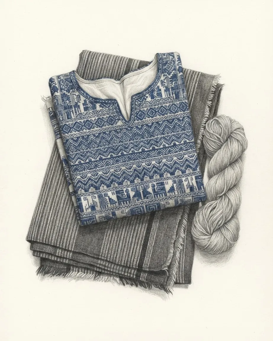
Lake Atitlán, the centre of the circuit, is an endorheic basin that fills the latest of three large calderas produced at Atitlán during the Pleistocene, with the volcanoes San Pedro, Atitlán and Tolimán built on its southern shore. The lakeside towns on INGUAT's list are Panajachel, which INGUAT's 2015 to 2025 plan counts as a conference destination with 178 rooms in four and five-star hotels, Santiago Atitlán, San Juan La Laguna, San Marcos La Laguna, San Antonio Palopó and Santa Catarina Palopó. Britannica places the K'iche' to the north and west of the lake and the Kaqchikel from its eastern shore to Guatemala City, and the dress worn in these towns is the subject of the census that counted it.
Two points in the UK advice bear on these towns. Guatemalan law requires visitors to carry identification, and a copy of the passport photo page is accepted in most of the country, but in San Pedro La Laguna in Sololá the local authorities may fine or detain a visitor who cannot show the original or a certified copy. The UK government's advice also asks travellers to photograph nobody, children above all, without permission, naming Quiché, Petén, San Marcos and Chiquimula, where accusations and fears of child kidnapping for adoption or organ theft have led to attacks that caught foreigners up; a small payment may be asked for a photograph.
Further west INGUAT's list takes in the city of Quetzaltenango, the hot springs of Fuentes Georginas, the volcano and lagoon of Chicabal and the volcanoes Santa María and Santiaguito. Tajumulco, at 4,220 metres, is on the same list.
What Tikal and the Petén forest hold
Tikal National Park covers 57,600 hectares in northern Petén and was inscribed by UNESCO in 1979 under both natural and cultural criteria. An inner urban zone of about 400 hectares holds the palaces, temples, ball courts and plazas; a wider zone of about 1,200 hectares covers the residential districts and the old reservoirs called aguadas; and more than 25 secondary sites lie in the periphery. Inscriptions at Tikal record 33 rulers over 1,161 years. More than 300 bird species have been recorded in the park, with five wild cats among them the jaguar and the puma.
The park has been protected in stages: a national monument in 1931, a national park in 1955, a World Heritage site in 1979, and from 1990 one core zone inside the Maya Biosphere Reserve. CONAP, the national council for protected areas, administers that reserve under Decree 5-90 over 2,090,667 hectares, in three zones that reach the municipalities of Las Cruces, La Libertad, San Andrés, San José, Flores and Melchor de Mencos. It counts 513 bird species in the reserve, 71% of those recorded in Guatemala.
The Penn Museum's Tikal Project depended on an airstrip. A dirt strip was cleared beside the swamp on the eastern edge of the ancient city after the Second World War, and in 1955 the Penn Museum appointed Edwin Shook to direct a project he had argued could be sustained entirely by air; its results have filled 33 volumes, and the excavations later passed to the government's Proyecto Nacional Tikal. Mundo Maya International Airport at Santa Elena, Flores, is one of the country's two international airports, and the 2011 CIEN study found Petén the only destination inside Guatemala with a domestic air connection.
UNESCO's assessment describes tourism at Tikal as mass tourism at seasonal peaks, with annual visitors in the hundreds of thousands, and lists solid waste, wastewater, erosion and vandalism among its effects. Armed guards and a specialised tourism police enforce the law in the park.
The rest of Petén is a list of sites in forest: Yaxha-Nakum-Naranjo, Uaxactun, about 20 km north of Tikal, Aguateca, Dos Pilas, Ceibal, Piedras Negras, the caves of Naj Tunich and the Mirador-Río Azul national park. El Mirador grew to about 16 square kilometres in the Late Preclassic and has a triadic pyramid covering six times the area of Temple IV at Tikal; the Maya civilisation survey that records it also calls it difficult to reach. Nojpetén, the Itza capital on an island in Lake Petén Itzá, fell to a Spanish assault in 1697, the last independent Maya kingdom to fall.
Where the coasts and the Verapaces lead
The Caribbean coast is Izabal, which INGUAT describes as unlike the rest of the country's tourism. The Garífuna, of African and Caribbean descent, live in Livingston and Puerto Barrios, and UNESCO inscribed the language, dance and music of the Garifuna in 2008. Quiriguá, inscribed as a World Heritage site in 1981, was the city of K'ak' Tiliw Chan Yopaat, who in AD 738 captured his overlord, the ruler of Copán, and had him ritually beheaded a few days later. INGUAT adds the Río Dulce national park, Lake Izabal, the Castillo de San Felipe de Lara and the coast at Punta de Manabique to the region.
The Pacific side runs through San Marcos, Retalhuleu, Suchitepéquez, Escuintla, Santa Rosa and the south of Jutiapa, with more than 300 km of beach used for surfing and fishing, sport fishing for sailfish, mangroves and turtle-nesting refuges at Monterrico. Takalik Abaj, in El Asintal, is on Guatemala's tentative list for World Heritage, and INGUAT presents it as a city where Maya and Olmec lived together. INGUAT also lists the Xocomil water park and the Xetulul amusement park.
North of the highlands, the Verapaces hold the travertine pools of Semuc Champey along the Cahabón, the caves of Lanquín, the Biotopo del Quetzal, the national park at Laguna Lachuá and the town of Cobán. The region also keeps the Rabinal Achí dance drama, inscribed by UNESCO in 2008, with a community museum devoted to it.
What the volcanoes ask of a climber
Volcano climbing is the activity the UK government singles out. Its advice is to check INSIVUMEH and CONRED, the national disaster agency, for access and restrictions before going up, and it records that some summits are high enough to freeze at night, that local organisers tend to underestimate the risks, that deaths have occurred and that there is no mountain rescue service.
Fuego's weekly reports show what the agencies track. In the week of 23 to 30 September 2026 it produced between one and seven explosions an hour, with gas-and-ash plumes up to 1.2 km above the summit and incandescent block avalanches down the Seca, Taniluyá, Ceniza, Honda and Las Lajas ravines. On 3 June 2018 its pyroclastic flows reached San Miguel Los Lotes and El Rodeo; CONRED had confirmed 110 deaths and 197 missing by 12 June 2018, with more than 12,500 people evacuated, and later Global Volcanism Program reporting gave 169 deaths and at least 256 missing. Pacaya, about 30 km east-south-east of Fuego and about 23 km south of La Aurora, is described by the same programme as almost constantly active, and the programme has traced plumes near the airport's southern approach to it.
How visitors enter and move around Guatemala
For holders of a British passport, the UK government's entry advice gives 90 days without a visa, a passport valid for six months after arrival with two blank pages, and an online immigration declaration to be completed before entering or leaving. Guatemala, El Salvador and Nicaragua share one 90-day period under the CA-4 agreement, which starts at the first entry and does not restart at each border; Honduras belongs to the agreement and requires British visitors to hold a visa. Children travelling alone or with one parent need a notarised letter in Spanish from the parent who is absent, and a yellow fever certificate is required from travellers arriving from a country with transmission risk.
The road network counted 16,293 km of highway and 4,564 km of rural road in 2012. Traffic drives on the right. Isolated roads are unpaved and may need four-wheel drive, police checkpoints are set up at random around Guatemala City, and PROVIAL, a roadside assistance force, patrols the main roads on 1520. Public buses are repainted United States school buses, and the UK advice steers visitors to private intercity coaches and to radio-dispatched taxis instead; INGUAT sells prepaid taxi vouchers in the arrivals hall at La Aurora, and its PROATUR service assists tourists who have been the victims of crime.
La Aurora has physical limits. INGUAT's 2014 analysis noted that La Aurora's altitude, the city's temperature and the length of its runway make transatlantic flights difficult; in 2014 its regular schedule offered 213 weekly flights, four of them to Madrid. Between June and December 2025 about 12,400 flights and 1.93 million seats were scheduled into the country.
The currency is the quetzal. British pounds are often impossible to exchange and US dollars easy. The mains supply is 120 volts on NEMA 1-15 and 5-15 sockets, the national police answer on 110 and the fire brigade on 122 or 123, and one time zone, six hours behind Coordinated Universal Time, covers the whole country.
Common questions
Questions about Guatemala
Where do Guatemala's foreign visitors come from?
Mostly from next door. In August 2026 El Salvador sent 145,444 of the 304,233 non-resident visitors and the United States 49,146, together 64% of the month. Honduras sent 26,615 and Belize 20,088. In 2014, 68% of arrivals came overland, and of those who flew, 49.3% came from the United States.
What draws pilgrims to Esquipulas?
The Black Christ in the Basílica del Señor de Esquipulas, venerated by visitors from southern Mexico and Central America according to INGUAT. About 30,000 motorcyclists ride there from Guatemala City each February in the Caravana del Zorro, declared intangible heritage of the nation in 2011. A joint Guatemalan and Panamanian nomination of the pilgrimage was before UNESCO in 2026.
What should a climber check before going up a Guatemalan volcano?
The current reports of INSIVUMEH, which monitors the volcanoes, and the access restrictions published by CONRED, the disaster agency. The UK government's advice adds that some summits freeze at night, that deaths have occurred, and that Guatemala has no mountain rescue service. Fuego was producing up to seven explosions an hour in late September 2026.
How does the CA-4 agreement change a long stay in Guatemala?
It puts three countries on one clock. For British passport holders, Guatemala, El Salvador and Nicaragua share a single 90-day period that begins at the first entry and does not restart at each border, though immigration checks still take place. The stay can be extended by up to 30 days before the 90 days run out. Honduras is in the agreement but requires British visitors to hold a visa, and expulsion from one country excludes a traveller from the others.
How long has Tikal been protected?
Since 1931, when it became a national monument. It was made a national park in 1955, inscribed by UNESCO in 1979 under both natural and cultural criteria, and became one core zone of the Maya Biosphere Reserve in 1990.