Guatemala's history: who would hold Maya land and Maya labour
3 019 words · 14 min · updated 2026-10-04
 Back to Guatemala
Of the victims Guatemala's truth commission could fully identify, 83% were Maya. The Commission for Historical Clarification reported in 1999 that more than 200,000 people had been killed or disappeared in an armed conflict it dated from 1962, and it concluded that agents of the state had committed acts of genocide against Maya groups between 1981 and 1983. It traced the war to an economy in which productive land sat in few hands. The conquest of 1524, the coffee laws of the 1870s and the land reform of 1952 each settled, for a time, what Maya land and Maya labour were for.
In short
- Maize cultivation
- As early as 3500 BC
- Conquest begins
- Q'umarkaj burned, 7 March 1524
- Last Maya kingdom falls
- Nojpetén, 13 March 1697
- Capital moved
- After the Santa Marta earthquakes of 1773
- Independence declared
- 15 September 1821
- Land reform
- Decree 900, 17 June 1952
- Árbenz resigns
- 27 June 1954
- Peace accord
- 29 December 1996
- Truth commission victims
- 83% of identified victims Maya (1999)
What the Maya built in the Petén before Spain
People were living in what is now Guatemala long before any city stood there. Hunter-gatherer sites from around 6500 BC have been found in the Quiché highlands and at Sipacate and Escuintla on the Pacific coast, and pollen from the Petén and the coast points to maize cultivation as early as 3500 BC. By 2500 BC small settlements were forming in the Pacific lowlands, at Tilapa, La Blanca, Ocós, El Mesak and Ujuxte, where the oldest pottery in the country has been found.
The record then turns monumental early. An altar at La Blanca in San Marcos dates to about 1000 BC. At Monte Alto, near La Democracia in Escuintla, giant stone heads and potbellied figures, the barrigones, date to around 1800 BC, and some scholars propose that the Olmec style began there; others argue that the only connection between those statues and the later Olmec heads is their size. Tak'alik Ab'aj in Retalhuleu carries both Olmec and Maya features.
The northern lowlands hold the densest cluster of Late Preclassic sites: Nakbé, El Tintal, Wakná, Xulnal, Uaxactún, Tikal and El Mirador, whose El Tigre and Monos pyramids together exceed 250,000 cubic metres. Richard Hansen, who directs the Mirador Basin project, argues that the basin held the first politically organised state in the Americas around 1500 BC, known in ancient texts as the Kan Kingdom, with 26 cities joined by stucco-paved causeways up to 40 metres wide. Other Maya archaeologists have challenged his dating, and the rise of Kaminaljuyu in the southern Maya area by the Late Preclassic suggests that civilisation evolved differently there and in the lowlands.
The Classic period, from 250 to 900 AD, is when the Petén filled with city-states. Tikal, inscribed by UNESCO as a national park of 57,600 hectares, keeps carved monuments whose hieroglyphic texts record the city's dealings with Teotihuacan and Calakmul in Mexico, Copán in Honduras and Caracol in Belize. In 2018 a Lidar survey of 2,100 square kilometres in the Maya Biosphere Reserve mapped 60,000 previously uncharted structures, and the researchers estimated that 7 to 11 million people lived in northern Guatemala between 650 and 800 AD.
Around 900 AD most of the central lowland cities were abandoned. The cause is still argued over. Lake-bed cores and ancient pollen have given weight to drought and famine; Britannica's account adds soil exhaustion and warfare to the list.
Why the conquest of the Maya took so long
Pedro de Alvarado, Hernán Cortés's second-in-command, entered the highlands from Soconusco in early 1524 with 300 Spanish foot soldiers, 120 horsemen and several hundred Tlaxcalan and Cholulan auxiliaries. The Nahuatl place names that still mark the map of Guatemala came with those Mexican allies, who translated for the Spanish.
Disease had arrived before him. Epidemics struck Iximche, the Kaqchikel capital, in 1519 and 1520, and modern estimates for populations with no prior exposure suggest that 33 to 50% of the highland population died. The highlands took until the middle of the 20th century to regain their pre-conquest numbers.
Alvarado allied with the Kaqchikel against their rivals, the K'iche', defeated the K'iche' army led by Tecún Umán, now Guatemala's national hero, and burned the K'iche' capital Q'umarkaj on 7 March 1524. He set up a base near Iximche on 25 July 1524 and campaigned outward from it: Chuitinamit of the Tz'utujil in 1524, Mixco Viejo of the Poqomam, Zaculeu of the Mam in 1525. The Kaqchikel then rose against excessive demands for tribute and held out against their former allies until 1530. Fighting went on until 1548, when the Q'eqchi' at Nueva Sevilla in Izabal were defeated.
North of the highlands lay a forest the Spanish called the Land of War and the Dominicans called Verapaz, True Peace. Bartolomé de las Casas reached the colony in 1537 and offered to bring it under the crown by preaching, and the governor signed a contract promising no new encomiendas there if the friars succeeded. Wherever the Spanish found a settlement in the forest, they moved its people into a new colonial town at the forest's edge, the policy of congregaciones, and the forest itself became a refuge for those escaping it.
The Itza kingdom on Lake Petén Itzá lay beyond all of this. Cortés made contact in 1525, and the kingdom stayed independent and hostile. Its island capital, Nojpetén, fell to an assault by Martín de Ursúa y Arizmendi on 13 March 1697, after his troops had built an armed oar-powered galley on the lakeshore. It was the last independent Maya kingdom, and it fell 173 years after Q'umarkaj burned.
What Santiago de Guatemala governed for the crown
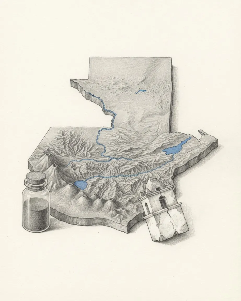
The colonial capital moved three times before it settled. Santiago de Guatemala was founded in 1524, burned in an indigenous uprising, re-established in 1527 and buried by earthquakes and an avalanche in 1541. The third site, in the Panchoy valley, was inaugurated in March 1543 on a grid plan that survives, and it served for 230 years until the Santa Marta earthquakes of 1773. The crown then ordered the capital moved to the site of present-day Guatemala City. The residents who stayed behind lived in what came to be called La Antigua Guatemala. UNESCO describes its Baroque as massive in build, with low bell towers designed to withstand the earthquakes.
From that city the captain general, the high court and the archbishop administered the whole region between Mexico and Panama. El Salvador, Honduras, Nicaragua, Costa Rica and Chiapas were provinces under Guatemala's jurisdiction.
Britannica sets the province against Mexico and Peru, which had large deposits of precious metals; colonial Guatemala developed no great prosperity and lived on agricultural staples grown for export, cacao and indigo first and cochineal dye toward the end of the period, produced by Indigenous or enslaved African labour. A satisfactory port was never developed, transport inland was difficult, and pirates worked the coasts. English goods came in through Belize despite Spanish efforts to keep them out.
The capital achieved, in Britannica's phrase, a certain magnificence, while the outlying areas were only lightly touched by Spanish culture. A governing city and a countryside that paid tribute and laboured for it: that division, and the land under it, is what independent Guatemala went on arguing about.
How Carrera's peasant army held the liberals off
On 15 September 1821 the captain general Gabino Gaínza and the criollo leader Mariano Aycinena y Piñol declared the territory independent. Aycinena then lobbied for annexation to Agustín de Iturbide's Mexican Empire, which followed in 1822. By 1824 Guatemala belonged to the Federal Republic of Central America, and Britannica names a Guatemalan uprising as the principal factor in the federation's collapse.
Its leader was Rafael Carrera, a backcountry caudillo whose rising drew on Indigenous peasants and conservative estate owners at once. Francisco Morazán's liberal forces ran a scorched-earth campaign against his villages in 1838; Carrera took Guatemala City by surprise on 13 April 1839. Britannica records that he was the military arbiter of the state from 1838 and controlled policy, from the executive's chair or behind it, until his death in 1865. He founded the Republic of Guatemala on 21 March 1847, and in 1854 the presidency was conferred on him for life.
Carrera restored the Church to its colonial privileges and governed much as the colony had, and the history record notes the other side of that settlement: Maya communal lands were strongly defended under his regime. His closeness to the Indigenous population was enough for Belize's British superintendent to fear, during the Caste War in Yucatán, that he might back the native risings there.
He also settled, on paper, the question of Belize. The Wyke-Aycinena Treaty of 30 April 1859 defined the border with Belize and acknowledged British sovereignty in exchange for a road from Guatemala City to the Caribbean that was never built. The liberal government that took power in 1871 declared the treaty void. In September 1991 Guatemala abandoned its claim of sovereignty over Belize and the two countries established diplomatic relations.
In 1850, under Carrera, Guatemala's population was estimated at 600,000.
What the coffee laws demanded of Maya labour
The Liberal Revolution of 1871, led by Miguel García Granados and Justo Rufino Barrios, opened a period of liberal government that ran almost unbroken to 1944. Barrios separated Church and State, confiscated the regular clergy's property, made elementary schooling free and compulsory, and replaced the Pontifical University of San Carlos with a secular national one. Dyes were by then being produced artificially in Europe, and his government promoted coffee in their place.
The coffee economy was assembled from two pieces of law. Decree 170, the Census Redemption Decree, allowed the public sale of Maya communal plots, and the land went to the army officers who had backed the revolution and to German settlers in the Verapaz. The Day Laborer Regulations then placed the native population at the disposal of the landlords. Indigenous Guatemalans were legally obliged to work on farms when owners required it, wherever their home towns lay, and local authorities dispatched them. Forced advance payments, habilitación, held them in debt to an employer, and a laborer without a booklet proving he owed nothing was exposed to the local authorities and the landlords alike. By the end of Barrios's administration, Britannica records, coffee had become Guatemala's leading export.
The instruments changed over the next sixty years; the demand on Maya labour held.
| Period | Instrument | What it required |
|---|---|---|
| 1520s onward | Encomienda and congregaciones | Tribute and labour, and resettlement into colonial towns |
| 1870s | Decree 170 | Public sale of Maya communal land |
| 1870s | Day Laborer Regulations | Farm work on demand, debt advances, the laborer's booklet |
| 1934 | Vagrancy law | At least 100 days of forced labour a year from landless men |
| 1952 | Decree 900 | Expropriation of idle land on estates over 272 hectares |
Manuel Estrada Cabrera, president from 1898 to 1920, continued along Barrios's lines and made large concessions to foreign companies. The United Fruit Company, formed in 1899, came to control Guatemala's railroads, docks and communications and held a monopoly over its banana trade; Estrada Cabrera was removed in 1920 when the assembly declared him insane. Jorge Ubico, elected without opposition in 1931, abolished debt peonage and replaced it with a vagrancy law under which every landless man of working age owed at least 100 days of labour a year. Britannica dates the law to 1934 and notes that it made workers, Indigenous workers especially, liable to forced labour at critical seasons. Ubico granted United Fruit 200,000 hectares of public land, exempted it from taxes and asked it to cap its workers' daily wage at 50 US cents.
Why the revolution's land reform ended in a coup
Ubico fell in 1944. Troops broke up a peaceful march of schoolteachers on 25 June and killed María Chinchilla; Ubico resigned on 1 July amid a general strike; and on 20 October 1944 a popular uprising deposed his successor, Federico Ponce Vaides. The ten years that followed are called the Guatemalan Revolution.
Juan José Arévalo, elected in 1944, introduced a labour code, social security and a minimum wage, and encouraged Indigenous leaders to organise in peasant leagues. His successor Jacobo Árbenz won the election of 1950, the first transfer of power between democratically elected leaders in Guatemala, and made land the centre of his government.
Decree 900, enacted on 17 June 1952, expropriated uncultivated land on holdings larger than 272 hectares and allotted it to landless families. Owners were paid in 25-year bonds at 3% interest, at the values they had declared in their own tax assessments. Of the nearly 350,000 private holdings in the country, 1,710 were affected. By June 1954 about 570,000 hectares had been distributed, and roughly 500,000 people, one in six Guatemalans, had received land, and the peasant families whose living standards improved were mostly Indigenous. The same account records that agricultural productivity, cultivated area and purchases of farm machinery rose slightly over the same years.
Britannica records that the reform had a heavy impact on the US-owned United Fruit Company. The government offered it Q 609,572 in compensation, calculated from the company's own tax filings, and the company replied that those values were outdated. It lobbied Washington, and the Truman and Eisenhower administrations both came to see Guatemala as a front in the Cold War. JSTOR Daily, summarising the historian Max Holland, records that the Dulles brothers, Eisenhower's Secretary of State and his CIA director, were financially linked with the company, and that Holland weighed Soviet moves above bananas in Eisenhower's thinking.
The CIA's operation, PBSuccess, armed and trained a force of exiles under Carlos Castillo Armas, recruited in Honduras, which invaded on 18 June 1954. The businessman William Pawley supplied its small air force, at one point paying for three aircraft from Nicaragua with a briefcase of his own cash. The army did not resist, and Árbenz resigned on 27 June 1954. Castillo Armas quashed the agrarian reform, broke the labour and peasant unions, and was assassinated by a member of his own presidential guard in 1957.
How counter-insurgency fell on Maya villages
The war began with a failed revolt by junior officers against General Ydígoras Fuentes on 13 November 1960; its survivors formed the MR-13 movement. The truth commission dates the armed conflict itself from 1962. In 1966 to 1968 the army's counter-insurgency in Izabal and Zacapa, under Colonel Carlos Arana Osorio, fielded paramilitary death squads and largely eliminated the rural guerrillas, and Arana took the presidency in 1970.
The second phase moved into the Maya highlands. The earthquake of 4 February 1976 killed more than 23,000 people, and the government's response drove survivors into independent organising. In the early 1970s more than 300,000 highland peasants were leaving the altiplano each year to work the Pacific plantations, and the Committee for Peasant Unity, the first Indian-led national labour organisation, organised among them. On 31 January 1980 displaced K'iche' and Ixil farmers occupied the Spanish Embassy in Guatemala City to protest killings in Uspantán; Rigoberta Menchú's father died there. On 23 March 1982 junior officers installed General Efraín Ríos Montt.
The commission's figures carry the argument of this article, and they are worth reading in its own terms. It registered 42,275 victims, of whom 23,671 were victims of arbitrary execution and 6,159 of forced disappearance, and estimated the total dead and disappeared at more than 200,000. It attributed 93% of the violations it documented to the state and allied paramilitary groups and 3% to the guerrillas, and it recorded 626 massacres by state forces. In the Ixil region 70 to 90% of the villages were razed. Between 500,000 and 1.5 million people were displaced at the height of the violence in 1981 to 1983, and about 150,000 sought safety in Mexico.
The genocide finding rests on four regions the commission examined in detail: the Q'anjob'al and Chuj of northern Huehuetenango, the Ixil of Nebaj, Cotzal and Chajul, the K'iche' of Joyabaj, Zacualpa and Chiché, and the Achi of Rabinal in Baja Verapaz. In them it found killings, serious harm and conditions of life imposed on Maya groups with intent to destroy them as such, and it concluded that these acts followed a policy planned above the units that carried them out.
The commission's reading of the causes goes back to the beginning of this article. From independence in 1821, it wrote, an authoritarian state had excluded the majority and protected a narrow propertied sector, on an economic structure in which productive assets were concentrated in few hands.
What the peace accords and the courts settled
The way out began in the region. At Esquipulas in 1987 the five Central American presidents accepted a peace plan that committed each government to negotiate with its insurgents. Rigoberta Menchú, a K'iche' woman whose memoir of 1983 had drawn international attention to the killings, was awarded the Nobel Peace Prize in 1992, and refugees in Mexico began to return in 1993. A new constitution with stronger human rights guarantees had been approved in May 1985.
The government and the guerrilla coalition, the URNG, signed a series of agreements under United Nations brokerage: on human rights in March 1994, on resettlement of the displaced and on historical clarification in June 1994, on indigenous rights in March 1995. The Oslo Agreement of 23 June 1994 created the truth commission. The final accord ending the war was signed on 29 December 1996.
Prosecution came later and was reversed. In May 2013 a Guatemalan court convicted Ríos Montt of genocide and crimes against humanity for the killing of at least 1,771 Ixil Maya during his rule in 1982 and 1983, and sentenced him to 80 years in prison. Before the month was out the Constitutional Court overturned the verdict and ordered the trial reset to its mid-April stage. A retrial resumed without him in 2017, and he died in April 2018 with it still under way. No final judgment on the genocide charge was ever handed down.
Two figures from the 2018 census frame where the argument ends. Of 14,901,286 people counted, 6,207,503, or 41.7%, identified as Maya, up from 39.3% in the 2002 census. That is a little over two Guatemalans in five.
Timeline
The dates in order
- c. 6500 BC
- Hunter-gatherer sites in Quiché and on the Pacific coast.
- c. 1800 BC
- Stone heads and potbellied figures at Monte Alto.
- 250–900
- The Classic Maya city-states of the Petén.
- 1524
- Alvarado burns Q'umarkaj on 7 March; Santiago de Guatemala is founded.
- 1543
- The capital is inaugurated in the Panchoy valley in March.
- 1697
- Nojpetén, the Itza capital, falls on 13 March.
- 1773
- The Santa Marta earthquakes; the capital moves to Guatemala City.
- 1821
- Independence declared on 15 September.
- 1839
- Carrera takes Guatemala City on 13 April.
- 1859
- The Wyke-Aycinena Treaty on Belize, 30 April.
- 1871
- The Liberal Revolution; coffee and the Day Laborer Regulations follow.
- 1944
- Ubico resigns on 1 July; the October Revolution on 20 October.
- 1952
- Decree 900 enacted on 17 June.
- 1954
- Castillo Armas invades on 18 June; Árbenz resigns on 27 June.
- 1960
- The officers' revolt of 13 November begins the civil war.
- 1982
- Ríos Montt installed by a coup on 23 March.
- 1996
- The peace accord of 29 December.
- 1999
- The truth commission reports genocide against Maya groups.
- 2013
- Ríos Montt convicted of genocide in May; the verdict is overturned.
Common questions
Questions about Guatemala
Who counted the dead of Guatemala's civil war?
The Commission for Historical Clarification, created by the Oslo Agreement of 23 June 1994, reported in 1999. It registered 42,275 victims and estimated more than 200,000 dead and disappeared, found that 83% of fully identified victims were Maya, attributed 93% of documented violations to the state and allied paramilitaries, and concluded that state agents committed acts of genocide against Maya groups in four regions between 1981 and 1983.
What drew the United States into the 1954 coup?
Árbenz's Decree 900 of 1952 expropriated idle land on large estates, and United Fruit, which had received 200,000 hectares from Ubico, lost heavily. The company lobbied Washington. JSTOR Daily, summarising the historian Max Holland, records that Eisenhower weighed Soviet moves above the company's interests, while noting the Dulles brothers' financial links to it.
How long could Maya kingdoms resist the Spanish conquest?
The highland kingdoms fell between 1524 and 1530, and fighting continued until 1548. The Itza kingdom in the Petén held out much longer: its island capital, Nojpetén, fell on 13 March 1697, 173 years after Alvarado burned Q'umarkaj.
Why is the old capital called Antigua?
Santiago de Guatemala stood in the Panchoy valley from March 1543 until the Santa Marta earthquakes of 1773, after which the crown ordered the capital moved to the site of Guatemala City. Residents who stayed behind lived in what became La Antigua Guatemala, the old Guatemala, whose grid plan and earthquake-built Baroque churches UNESCO has inscribed.
Was Ríos Montt convicted of genocide?
A Guatemalan court convicted him in May 2013 of genocide and crimes against humanity for the killing of at least 1,771 Ixil Maya during 1982 and 1983, and sentenced him to 80 years. The Constitutional Court overturned the verdict within the month. A retrial was still under way when he died in April 2018, so no final judgment stands.