Why Costa Rica lives on the line where its rivers part
2 902 words · 13 min · updated 2026-10-04
 Back to Costa Rica
San José stands at 1,160 metres in the Valle Central, an upland basin that straddles the continental divide, so that its eastern part drains to the Caribbean through the Reventazón and its western part to the Pacific through the Grande de Tárcoles. Britannica's entry, revised in September 2026, puts more than half of Costa Rica's population in that basin, beneath the active craters of Irazú and Poás. The country's people therefore live on the line where its rivers part, about 120 kilometres from sea to sea at the narrowest point, and every road, railway and oxcart track to either coast has had to climb down a mountain range from there.
In short
- Area
- 51,180 km², with a coast on two oceans
- Heartland
- Valle Central, split by the continental divide
- Highest point
- Cerro Chirripó, 3,819 m
- Coastline
- Pacific 1,016 km, Caribbean 212 km (Wikipedia)
- Narrowest width
- about 120 km, sea to sea
- Land borders
- Nicaragua 313 km, Panama 348 km
- Exclusive economic zone
- 574,725 km², carried by Isla del Coco
- Climate regions
- seven, in the IMN's division
Why Costa Ricans settled on the continental divide
The Valle Central, also called the Meseta Central, is where the Spanish crown placed its first permanent settlement in what is now Costa Rica, the village of Cartago, in 1564. It lies between the volcanic ranges to the north and the Cordillera de Talamanca to the south, and the continental divide runs across it. Britannica describes the eastern part as drained by the Reventazón River to the Caribbean and the western part as belonging to the basin of the Grande de Tárcoles, which flows into the Pacific. Rain falling on the same valley floor therefore reaches two different oceans.
Britannica's entry, revised in September 2026, places more than half of the country's population in the Valle Central and describes the basin as devoted to coffee. San José had 335,007 residents on 1 January 2025 by the record's count, and it stands at about 1,160 metres. The capital moved there from Cartago after the civil war of 1823, decided at the Hill of Ochomogo, which is itself in the Central Valley.
Altitude is what made the basin worth settling at ten degrees north. Britannica gives San José a mean temperature of 21 °C, against 27 °C at a station at 210 metres and 15 °C at one at 2,340 metres. The Wikipedia geography article puts the mean at about 27 °C on the coastal lowlands, 20 °C in the main populated areas of the Cordillera Central and below 10 °C on the highest summits. A population that settled a thousand metres up gained a temperate climate inside the tropics and paid for it in distance, because everything it grew for export had to be carried down a mountain to reach a ship.
The western river carries the cost of that concentration. In 2007 the Constitutional Court ordered the national government and 34 local governments to stop dumping sewage into the Río Grande de Tárcoles, to restore the watershed to an unpolluted condition and to adopt an integrated solution to wastewater.
How two mountain systems form one spine
Two mountain chains together run almost the entire length of Costa Rica, and Britannica treats them as different in kind. In the north is the Cordillera Volcánica, which divides from northwest to southeast into the Cordillera de Guanacaste, the Cordillera de Tilarán and the Cordillera Central. In the south is the Cordillera de Talamanca, a massive granite batholith. The Cordillera de Guanacaste near the Nicaraguan border forms part of the Continental Divide of the Americas, and the Cordillera Central and the Talamanca between them separate the Pacific and Caribbean drainage.
What drives the volcanic north
The volcanoes come from the plate boundary offshore. Costa Rica sits on the Caribbean Plate, and the Cocos Plate in the Pacific is being subducted beneath it, which forms the Central America Volcanic Arc. Wikipedia counts 14 known volcanoes, six of them active in the last 75 years.
Irazú reaches 3,432 metres in Britannica's figures and 3,431 in Wikipedia's, and Poás 2,704 metres. Both have paved roads to the rims of their active craters, and both overlook the Valle Central, which is why Britannica lists them as a serious natural hazard, together with the earthquakes that affect most of the country. The earthquake of 1910 destroyed the Cartago headquarters of the Central American Court of Justice, and the court moved to San José.
Arenal, a stratovolcano of 1,633 metres about 90 kilometres northwest of San José, erupted in 1968 and destroyed two villages. It went on producing lava and breccia into the early 21st century.
What the granite south carries
The Talamanca holds the summit. Britannica and the Wikipedia country article give Cerro Chirripó at 3,819 metres, and the Wikipedia geography article at 3,821. The range also holds Cerro Kamuk, and much of it lies inside La Amistad International Park, which Costa Rica shares with Panama. Above 3,000 metres on Chirripó and in La Amistad the vegetation is páramo, and on the Talamanca evergreen oaks give way above the timberline to mountain scrub and grasses. Britannica records the range's designation as a UNESCO World Heritage site in 1983.
What the lowlands on either side are like
The spine leaves less flat ground than an outline suggests. Britannica puts the Caribbean lowlands, north and east of the mountains, at about one fifth of the country, all of it below 120 metres. The Pacific lowlands, a run of small valleys and plains, cover only about one tenth. A further structural valley, the Valle del General, lies at the foot of the Talamanca in the south. Wikipedia's land use figures give arable land as 4.8% of the territory and permanent crops as 6.66%.
The two coasts differ in length by a factor of three to five, and the sources do not agree on one of them. Wikipedia gives 212 kilometres of Caribbean coastline and 1,016 of Pacific; Britannica gives about 300 and 1,015. The Pacific figures agree within a kilometre. The Caribbean figures are 88 kilometres apart, and neither source says how it measured.
Both gulfs are on the Pacific side. Mangroves grow on the shallow protected shores of the Gulf of Nicoya and the Gulf of Dulce, and the Gulf of Nicoya is where small-scale artisanal fishing is most common. The northwest, with the longest dry season, carries open deciduous forest. Palms line the Caribbean coastline.
In the south, sediment has preserved what the rest of the country lost. UNESCO lists four archaeological sites in the Diquís Delta, Finca 6, Batambal, El Silencio and Grijalba-2, settled by chiefdom societies between AD 500 and 1500. They hold artificial mounds, paved areas, burials and stone spheres between 0.7 and 2.57 metres in diameter. UNESCO attributes their survival, where the vast majority of archaeological sites in Costa Rica were looted, to thick layers of sediment that kept them buried for centuries. Grijalba-2 is distinguished by its use of limestone, and Finca 6 is the only one that keeps its spheres in linear arrangements. When the sites were assessed, a Diquís hydroelectric dam and a southern international airport were both under discussion nearby.
Why the two slopes keep different rain calendars
The Instituto Meteorológico Nacional (IMN) begins its climate regions from the mountains. The system runs northwest to southeast and so divides the country into a Pacific slope and a Caribbean slope, each with its own regime of rainfall and temperature.
On the Pacific slope the dry season runs from December to March, with April as a month of transition and March as the driest and hottest. The rains run from May to October, with November as a transition, and they ease in July and August during the veranillo, or canícula, when the trade wind strengthens. September and October are the wettest months, under cyclonic systems, monsoon winds from the equatorial Pacific and sea breezes meeting the mountains.
The Caribbean slope has no defined dry season. Even its least rainy months bring 100 to 200 mm. The coast has two relatively dry spells, in February and March and again in September and October, and its wettest month is December, under cold fronts from the Northern Hemisphere that arrive between November and May. The second Caribbean dry spell falls in the weeks of heaviest Pacific rain, and the Caribbean maximum in July falls inside the Pacific veranillo. On a day in October the two sides of the divide can be in opposite seasons.
| Slope | Dry period | Wettest months | What drives the rain |
|---|---|---|---|
| Pacific | December to March, April transitional | September and October | cyclonic systems, Pacific monsoon winds, sea breezes |
| Caribbean | no defined dry season; February to March and September to October relatively dry on the coast | December, with a second peak in July | cold fronts from the north, November to May |
From the two regimes, the height and orientation of the mountains, the prevailing winds and the oceans, the IMN distinguishes seven climate regions: Pacífico Norte, Pacífico Central, Pacífico Sur, Región Central, Zona Norte, Caribe Norte and Caribe Sur. Its baseline is the standard period from 1961 to 1990, built from 81 stations, of which 50 held precipitation records for the whole period and were current in 2006.
Residents name the seasons by rain. The dry months from December to April are verano, summer, and the rainy months from May to November are invierno, winter. The heaviest totals fall on the Caribbean slopes of the Cordillera Central, at over 5,000 mm a year in Wikipedia's figures, and Britannica places the heaviest Caribbean amounts in the Barra del Colorado region. San José, on the divide, receives well under 25 mm in February and more than 300 mm in September, and over 1,800 mm in an average year.
How rain on the divide becomes electricity
Costa Rica has found no fossil fuel sources apart from minor coal deposits, and the Wikipedia economy article credits the mountainous terrain and abundant rainfall with a dozen hydroelectric power plants. Lake Arenal is used for hydropower.
The Instituto Costarricense de Electricidad (ICE) reported in February 2026 that 98.6% of the electricity produced in 2025 came from five renewable sources: water, geothermal heat, wind, biomass and sun. That figure includes exports to the rest of the isthmus. Domestic demand alone was met 97.3% from clean sources in the same year, and the share in 2016 had been 98.1%.
Each of those sources has a place on the map. Water comes off both slopes of the spine. Geothermal heat comes from the volcanic north, where ICE is building the Borinquen I plant at Liberia in Guanacaste. ICE expects close to 600 megawatts of new geothermal, solar and wind capacity by 2030, and in September 2026 it announced seven solar plants in four cantons of Puntarenas province. The economy article adds that the mild highland climate and the trade winds make neither heating nor cooling necessary in the highland cities and towns.
Who pays for the forest that came back
The Wikipedia geography article records deforestation running at very high rates from 1973 to 1989 and reduced to almost zero by 2005. The national branding strategy announced in October 2023 cites 57.1% national forest cover, with 25.5% of the land and 30.3% of the maritime territory protected. Britannica's figure is narrower in scope: dense broad-leaved evergreen forest, with mahogany and tropical cedar, over about one third of the country.
The mechanism is a payment written into law. Under Forest Law No. 7575, the Fondo Nacional de Financiamiento Forestal (FONAFIFO) pays owners and holders of forest and forest plantations for four environmental services: the mitigation of greenhouse gas emissions, the protection of biodiversity, the protection of water for urban, rural or hydroelectric use, and natural scenic beauty for tourism and science. FONAFIFO describes the programme as replacing the idea of a subsidy with economic recognition of what a forest provides, and dates the legal change to the 1990s. The third service ties the forest on the slopes to the reservoirs in the previous section: keeping trees above a hydroelectric catchment is one of the things the state pays for.
The protected land is administered by the Sistema Nacional de Áreas de Conservación (SINAC), created by Article 22 of Biodiversity Law No. 7788 of 1998. SINAC divides the country into eleven conservation areas, and its categories run from forest reserves, protective zones, national parks and biological reserves through wildlife refuges in state, private and mixed ownership to wetlands, natural monuments, marine reserves and marine management areas.
What the forest holds follows from the land bridge. The Caribbean Plate's migration and a sea-level low stand in the Late Paleocene produced a connection over which groups of mammals took part in an interchange, and Britannica describes the country's mammals as having major ties to both South and North American populations: monkeys, anteaters and sloths from the south, and deer, wildcats, weasels, otters, coyotes and foxes from the north. Wikipedia counts about 12,119 plant species, 950 of them endemic, and gives the country about 0.03% of the world's landmass and 5% of its biodiversity; the 2023 strategy puts the biodiversity share at 6.5%. Corcovado National Park holds all four of the country's monkey species.
How far the territory reaches into the Pacific
Article 5 of the Constitution places the national territory between the Caribbean Sea, the Pacific Ocean and the republics of Nicaragua and Panama, and then adds a sentence of its own: the Isla del Coco, situated in the Pacific Ocean, forms part of the national territory. Article 6 claims sovereignty over territorial waters to twelve miles from the low-tide line, over the continental platform and over the insular base.
Cocos lies about 550 kilometres from the Pacific shore, and it is the country's southwestern extreme. Wikipedia counts about 79 islands in all, with Isla Calero the biggest by area. Cocos is what carries the claim offshore. Wikipedia gives an exclusive economic zone of 574,725 square kilometres against a land and water area of 51,180 in the record, more than eleven times the land, and the main Wikipedia article records a maritime border with Ecuador to the south of Cocos Island.
On land the borders run 313 kilometres with Nicaragua and 348 kilometres with Panama. The Constitution names the treaties that fix them: the Cañas-Jérez Treaty of 15 April 1858, ratified by the Cleveland award of 22 March 1888, for Nicaragua, and the Echandi Montero-Fernandez Jaen Treaty of 1 May 1941 for Panama. Both edges moved before they were fixed. On 25 July 1824 an open town meeting in Nicoya voted to join Costa Rica, and Chiriquí was part of Costa Rica until 1849, when it became part of Panama.
The San Juan River defines the border with Nicaragua, and navigation on it has been disputed for a long time. In July 2009 the International Court of Justice upheld Costa Rica's navigation rights for commercial purposes, and in 2010 a further dispute arose around Isla Calero and the effects of Nicaraguan dredging of the river. This catalogue records the rulings and the dispute and takes no position on either.
How the valley's goods reached the two coasts
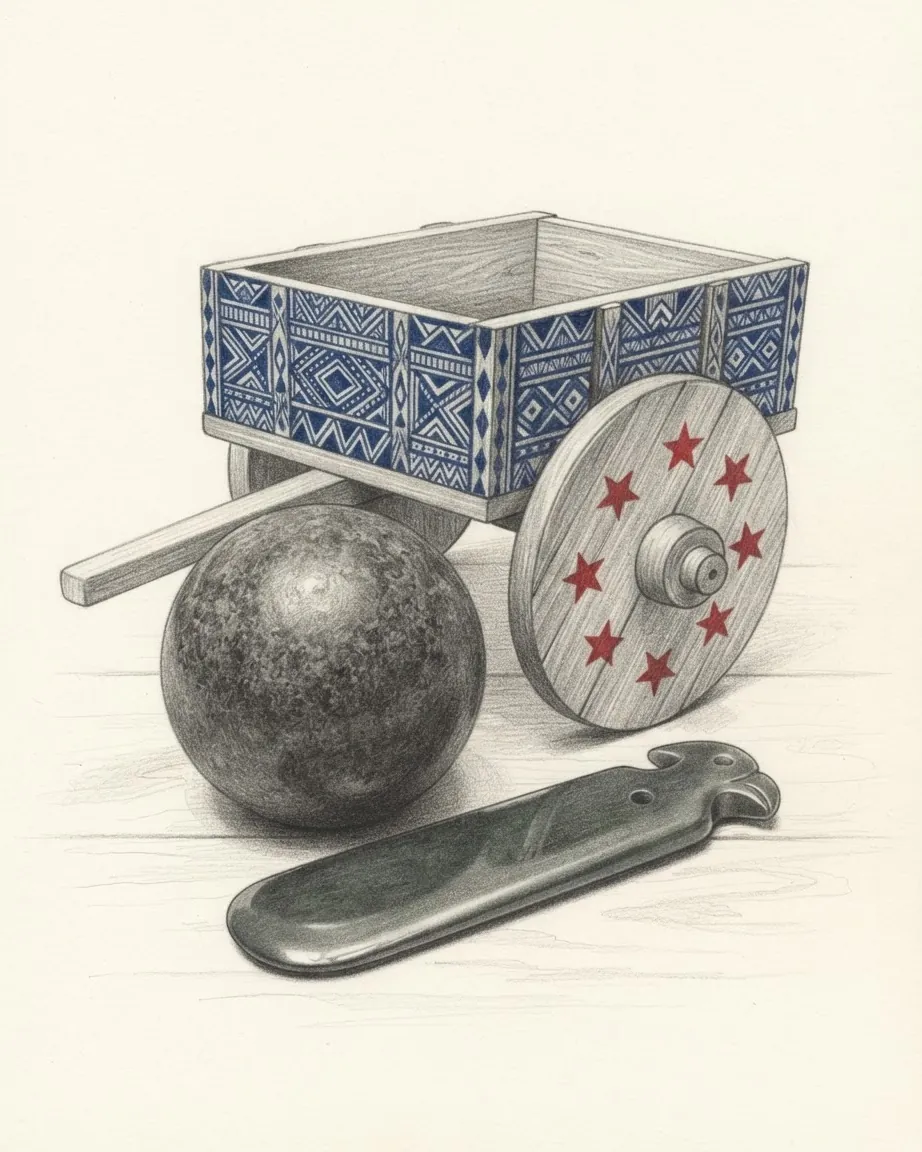
The first route out of the basin went west. Britannica dates a constant stream of oxcarts carrying coffee from the Valle Central to the Pacific ports from the 1840s, and UNESCO puts the trip over the mountains to Puntarenas at ten to fifteen days. The carts ran on spokeless wheels, a hybrid between a solid disc and a spoked wheel, built to cut through the mud without sticking. When painting the carts began in the early twentieth century, each region had its own design, so that a driver's origin could be read from the patterns on his wheels. UNESCO inscribed the tradition on its Representative List in 2008.
The Pacific port faced the wrong ocean for the buyers. Before the Panama Canal opened, ships from Europe had to sail around Cape Horn to reach the Pacific coast, and the coffee areas of the Central Valley had access only to Puntarenas. A trade route to Europe was set up in 1843 with the help of William Le Lacheur, a Guernsey merchant and shipowner. The Caribbean route came by rail: in the 1870s the government contracted Minor C. Keith to build a line from San José to Limón, and it was completed in 1890.
The railway changed who lived on the Caribbean side, and law then held them there. Britannica records that workers brought mainly from Jamaica to build the Atlantic Railroad and work on the banana plantations were restricted to the Caribbean coast by residence laws. A law of 1935 prohibited banana plantation owners on the Pacific coast from employing "coloured" people, and when Panama disease hit the Atlantic crop in the late 1930s and operations moved to the Pacific, some Costa Ricans lobbied for laws barring the employment of black workers. A government measure of 1949 ended the restriction and allowed black residents of Limón to travel, enter the Valle Central and become citizens. Limón remains where the large majority of Afro-Costa Ricans live.
Today the highland cities of the Central Valley are joined to both coasts by paved all-weather roads, and to Nicaragua and Panama by the Pan-American Highway. The Camino de Costa Rica, a hiking trail of 280 kilometres, crosses the country from the southern end of the Tortuguero Canals on the Caribbean, through indigenous territory near Barbilla National Park and south of the Turrialba and Irazú volcanoes, and on through the Los Santos coffee region. Costa Rica: history tells how the country was built from the basin outward, Costa Rica: economy what the coffee, the bananas and the electricity are worth, and Costa Rica: travel how the two slopes and their seasons are reached.
Surroundings
Which countries border Costa Rica
Recorded as shared borders, which includes neighbours across water: Costa Rica has a coast, and the list reads accordingly. Hover a row to find the country on the map; the distance is capital to capital, in a straight line.
 Nicaragua
 Panama
Common questions
Questions about Costa Rica
Does the Valle Central drain to the Caribbean or the Pacific?
To both. The continental divide crosses the basin, so its eastern part drains through the Reventazón River to the Caribbean and its western part belongs to the basin of the Grande de Tárcoles, which reaches the Pacific. Britannica's entry, revised in September 2026, places more than half of Costa Rica's population in the Valle Central.
Which months are dry in Costa Rica?
It depends on the slope. On the Pacific side the IMN places the dry season from December to March, with April as a transition, and the rains from May to October, easing in July and August. The Caribbean slope has no defined dry season: its least rainy months still bring 100 to 200 mm, and its wettest month is December, when cold fronts arrive from the north. Residents call the dry months verano and the wet ones invierno.
Does Cocos Island belong to Costa Rica?
Yes. Article 5 of the Constitution states that the Isla del Coco, situated in the Pacific Ocean, forms part of the national territory. It lies about 550 kilometres from the Pacific shore and it is what extends the exclusive economic zone to 574,725 square kilometres in Wikipedia's figure.
How many volcanoes does Costa Rica have?
Wikipedia counts 14 known volcanoes, six of them active in the last 75 years, all of them in the northern ranges that Britannica groups as the Cordillera Volcánica. Irazú, at 3,432 metres in Britannica's figures, and Poás, at 2,704 metres, have paved roads to the rims of their active craters and overlook the Valle Central. Arenal erupted in 1968 and destroyed two villages. The Cordillera de Talamanca in the south is granite and carries the summit, Cerro Chirripó, instead.