The rain that keeps Panama's isthmus crossable
3 204 words · 15 min · updated 2026-10-04
 Back to Panama
Every ship that crosses Panama is lifted about 27 metres on rainwater and lowered again by letting that water run into the sea. The water comes from Gatun Lake, made by damming the Chagres River where the continental divide sinks to a low saddle, and the same reservoir system supplies more than half the country's population. In October 2023 rainfall came in 41% below normal, and by early December the canal had cut its daily transits from 36 to 22.
In short
- Isthmus
- 772 km long, 60 to 177 km wide
- Gatun Lake level
- about 27 m above sea level
- Water lost per downward lockage
- about 101,000 m³, old locks
- Annual rainfall
- under 1,300 mm to over 3,000 mm
- Tidal range
- over 7 m Pacific, about 70 cm Caribbean
- Highest point
- Volcán Barú, 3,475 m
- Forest and rastrojo
- 67.15% of the territory (2023)
- Coastline with islands
- about 2,988 km
Where the continental divide drops to a saddle
Panama occupies an S-shaped isthmus 772 kilometres long and between 60 and 177 kilometres wide, and a spine of mountains and hills runs down its length to form the continental divide. The spine belongs to neither continent's great chains. It is the heavily eroded arch of an uplift from the sea floor, its peaks formed by volcanic intrusions, and highlands related to the Andes appear only near the Colombian border.
West of the canal geographers call the spine the Cordillera Central, and it carries three ranges. The Cordillera de Talamanca comes in from Costa Rica and holds Volcán Barú, 3,475 metres, which last erupted in 1550 and is the apex of a highland in the far west. Frost forms in the Talamanca, and pipes have frozen there as low as 2,100 metres. Further east the Serranía de Tabasará and the Sierra de Veraguas lose height towards a low saddle.
The canal occupies that saddle. Gatun Lake forms the summit stretch of the waterway, and the Culebra Cut takes ships 12.5 kilometres through the ridge and across the divide itself.
The bend of the isthmus there produces two facts that read like errors. A ship travelling from the Atlantic to the Pacific heads from north-west to south-east, and the Bridge of the Americas at the Pacific end stands about a third of a degree east of the Colón end on the Caribbean. In central Panama the sun rises over the Pacific and sets over the Atlantic.
East of the canal the land climbs again into the Darién, where the main ranges are volcanic, built of tuffs and lava, and Cerro Tacarcuna reaches 1,875 metres near the border with Colombia. The record gives the total area as 74,177 square kilometres; the World Factbook figures carried in Wikipedia's geography article give 75,420, of which 1,080 are water. Land boundaries run 555 kilometres in the Factbook's figures, 330 with Costa Rica and 225 with Colombia.
How the rain splits at the divide
Temperature does little to separate one part of Panama from another. The mean of the coldest month seldom falls below 26 °C on either coast, a dry-season morning in the capital may start at 24 °C, and the temperature seldom exceeds 32 °C for more than a short time. Rain is what divides the country, and it varies from less than 1,300 millimetres a year in the driest regions to more than 3,000 in the wettest.
The divide decides where it lands. Moisture comes off the Caribbean on north and north-east winds for most of the year, and the mountains act as a rain shield for the Pacific lowlands behind them. Britannica gives the Caribbean coast 1,500 to 3,550 millimetres a year and the more populated Pacific region 1,140 to 2,290. On the Caribbean slopes of the Tabasará, which face the trade winds, the average is about twice that of the Pacific slopes. Panama City, on the Pacific, receives a little more than half the annual rainfall of Colón on the Caribbean.
The seasons differ as much as the totals. On the Caribbean side rain falls almost throughout the year. On the Pacific side the year divides in two: in Chiriquí the dry season runs from January to April, and March is usually the driest month. The rainy season lasts seven to nine months, given as May to November in one account and April to December in another, and towards the Colombian border both sides of the isthmus are wet all year. In late autumn a south-west wind off the Pacific brings some rain to the Pacific lowlands, and the highlands of the Azuero Peninsula shield much of central Panama from it.
Vegetation follows the water. Rainforest is typical on the Caribbean slopes, and savanna on the seasonally dry ground between the Tabasará and the Pacific shore, which is where the cattle ranches of Chiriquí, Los Santos and Veraguas sit. Altitude sorts the land a second time. Ground below 700 metres, nearly nine tenths of the territory, is hot and grows cacao and bananas. The temperate band from 700 to 1,500 metres covers most of the rest and grows coffee. Above it lies a cold zone of small extent.
Panama lies outside the Main Development Region for tropical cyclones. The natural hazards the Factbook lists are occasional severe storms, forest fires in the Darién and earthquakes.
What a single transit takes from the lake
The Chagres River drains north-west into the Caribbean, and between 1907 and 1913 the Gatun Dam was built across it. The lake behind the dam carries ships 24 kilometres across the isthmus at some 27 metres above sea level, and the expansion that opened in 2016 raised its maximum level from 26.7 to 27.1 metres. Alajuela Lake, called Madden Lake under the American administration and also filled from the Chagres, holds a second reserve.
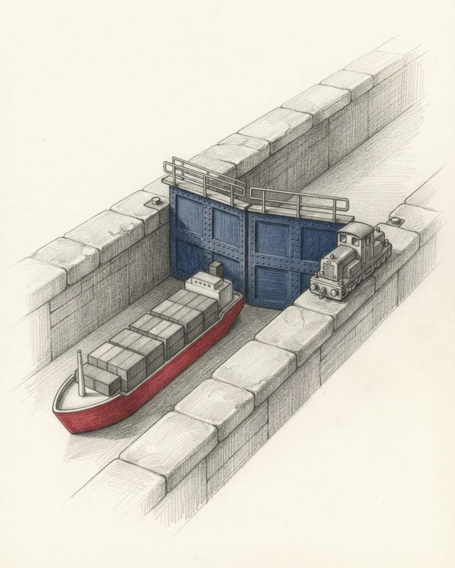
A three-stage flight of locks lifts ships from the Caribbean to the lake. On the Pacific side the old route steps down through the Pedro Miguel Lock, Miraflores Lake and the two-stage Miraflores Locks, and Neopanamax ships descend through the three-stage Cocolí flight. All of it runs on gravity. Water flows from the lake into a chamber to raise a ship, and out of the chamber towards the sea to lower one, and that water does not return to the lake. In the old locks about 101,000 cubic metres go to the ocean with each downward lock movement, whatever the size of the ship. An environmental account of the canal puts the fresh water needed for each ship that passes through at about 200 million litres.
The locks opened in 2016 were built around that loss. Each new flight has nine water-saving basins, three to a chamber, each about 430 metres long and 5.5 metres deep. They let 60% of the water used in a transit be reused, and the new locks use 7% less water per transit than each lane of the old ones.
The lake has a second job. Gatun is Panama City's primary source of drinking water, and the canal authority stated in May 2026 that both the canal's operations and the water supply for more than 50% of the population depend on the same resource. A transit and a household tap draw on one reservoir system, and each wet season the Chagres basin has to refill it with rain.
The two oceans at the ends of the canal do not stand at quite the same height. Mean sea level on the Pacific side is about 20 centimetres higher than on the Atlantic, from differences in water density and weather.
What happened when the rain failed
The basin has come up short before. The 2015 to 2016 fiscal year was one of the driest periods on record and restricted passage, and in a drought in 2019 Gatun fell to historic lows. October 2023 went further. The canal authority recorded 41% less rainfall than usual that month and called it "the driest month of October since 1950", the start of its records 73 years earlier, with El Niño behind it. Gatun Lake fell to levels without precedent for the time of year, with less than two months of the rainy season left to refill it.
The canal rations water by rationing ships. In normal times 36 ships can transit each day. In early December 2023 only 22 were allowed, and in January 2024, 24. The authority published a falling schedule of reservation slots, 25 a day from 3 November 2023 down to 18 from 1 February 2024, on top of cross-filling in the old locks and the reuse basins in the new ones. The canal recorded 11,240 transits in fiscal 2024. Fiscal 2025 brought 13,404, an increase of 19.3%.
| Period | Ships allowed through each day |
|---|---|
| Normal operation | 36 |
| Early December 2023 | 22 |
| January 2024 | 24 |
| May 2026 | 38 |
| From 3 September 2026 | 34 |
| From 15 September 2026 | 32 |
The authority's own reading of the record is that El Niño recurs within two to seven years, and that a moderate or strong event shows its sharpest effects in the year after it begins, as in 1982 to 1983, 1997 to 1998, 2015 to 2016 and 2023 to 2024. With another event expected for the second half of 2026, it brought in water-saving measures in the last week of December 2025. Two small ships were locked through together where their size allowed. The reuse basins at the Neopanamax locks were used during changes of direction, saving one cubic hectometre a day. Interior gates cut the volume needed to fill a chamber according to the ship's length, and hydroelectric generation at Gatún was suspended so the water would be kept for drinking and for transits.
The 2026 dry season, in the authority's words, "was among the wettest on record since 1950", and in May 2026 the canal was holding 38 daily transits and forecasting no restriction before 31 December 2026. By September the forecast had been overtaken. From 3 September 2026 the waterway allowed 34 ships a day, and from 15 September 2026, 32, because of low rainfall in an intensifying El Niño.
Where the next reservoir will flood
The response to 2023 is a second river. After the droughts of 2023 and 2024 the authority announced a reservoir of 4,600 hectares on the Río Indio, to hold about 1.25 billion cubic metres behind a dam at an estimated cost of US$1.6 billion. It is expected to allow up to 15 more transits a day in the dry season and to supply drinking water to more than half the population. A Supreme Court decision in 2023 redefined the legal boundaries of the canal's watershed, which is what let a project beyond the traditional limits go ahead.
The reservoir will also cover villages. An estimated 2,000 people would be displaced. The authority began public consultations on mitigation and compensation in 2024, and as of March 2026 relocation of the affected families was due to begin in 2027, with construction from 2028 and completion by 2031.
The volume the existing lakes can hold depends on the slopes around them. Researchers warned in 1978 that "clearing the forest in the [drainage basin] might kill the canal", and by 1985 the forested share of the basin had dropped to 30%. Erosion from cleared ground raises the beds of Gatún and Alajuela and reduces how much water they store, and the Factbook lists soil erosion that threatens siltation of the canal among the country's environmental issues.
Why the two coasts keep different tides
On the Caribbean coast the tide rises and falls about 70 centimetres. On the Pacific coast the range exceeds 7 metres, and some 130 kilometres up the Río Tuira it is still over 5 metres. The difference comes from the floor of the sea. The Pacific coastal waters are extremely shallow, depths of 180 metres are reached only outside the Gulf of Panama and the Golfo de Chiriquí, and at low water mud flats extend up to 70 kilometres seaward. A global remote-sensing analysis put Panama's tidal flats at 1,016 square kilometres. The shrimp and fish catch comes mostly from the shallow continental shelf of the Gulf of Panama.
The two coasts differ in outline as well. The Caribbean coast is concave and lined with hundreds of islands. Near the Costa Rican border the Bocas del Toro archipelago shelters the banana port of Almirante, and further east more than 350 low sandy San Blas Islands are strung out for over 160 kilometres along the coast of the Guna Yala comarca. The Pacific coast is convex, cut into gulfs and pushed out into peninsulas. The Azuero Peninsula projects south between the Gulf of Panama and the Golfo de Chiriquí, the Pearl Islands in the Gulf of Panama number more than 200, and some 1,000 islands lie off the Pacific coast in all. Coiba, in the Golfo de Chiriquí, held a penal colony and became a national park in 1991.
| Pacific | Caribbean | |
|---|---|---|
| Coastline with islands | 1,700.6 km | 1,287.7 km |
| Tidal range | over 7 m | about 70 cm |
| Shape | convex, gulfs and peninsulas | concave, lined with islands |
| Rainfall a year | 1,140 to 2,290 mm | 1,500 to 3,550 mm |
| Rivers | more than 300, longer and slower | shorter and swift |
| Principal canal port | Balboa | Cristóbal |
Counted with its islands and indentations the coastline runs about 2,988.3 kilometres, against the 2,490 kilometres usually cited for the land alone.
The rivers split the same way. Nearly 500 rivers cross Panama, most of them unnavigable, many starting as swift highland streams and ending in coastal deltas. More than 300 drain to the Pacific, and these are longer and slower, with larger basins. The Tuira, which flows into the Golfo de San Miguel, is the one river in the country that larger vessels can navigate.
A second engineered crossing runs near the western border. Deep-water ports able to take very large crude carriers stand at Charco Azul on the Pacific and Chiriquí Grande on the Caribbean, and the Trans-Panama pipeline has run 131 kilometres between them since 1979.
How much of Panama is forest
The answer depends on what counts. Wikipedia's article on the geography of Panama puts the wooded share at nearly 40% and says tree cover has been reduced by more than 50% since the 1940s. The environment ministry's own 2023 diagnostic, published on 20 August 2024, found 67.15% of the territory under forest and rastrojo, with 4,737,067 hectares of forest and about 325,666.78 hectares of rastrojo.
Rastrojo is the word that moves the figure. Resolution DM-0148 of 21 July 2022 defines it as secondary vegetation of trees, shrubs and herbs that appears naturally after farming, averaging under 5 metres in height. The ministry's report notes that the Forest Law gives rastrojo no adequate protection, although it is land in regeneration that can become secondary forest.
| Measure | Figure | Date |
|---|---|---|
| Forest and rastrojo, ministry diagnostic | 67.15% of the territory | 2023 |
| Forest alone, ministry diagnostic | 4,737,067 ha | 2023 |
| Forest and wooded land lost in two years | 352,873 ha, 4% | to 2023 |
| Tree cover over 30% density, Global Forest Watch | 5,734,588 ha | 2000 |
| Tree cover lost, Global Forest Watch | 530,647 ha, 9.3% | 2001 to 2024 |
Both series record loss. The ministry counted 352,873 hectares of forest and other wooded land lost in two years to 2023, a 4% reduction nationally, and gives Veraguas 37.6%, Coclé 18% and Darién 15.9%. Global Forest Watch, which reads Landsat imagery and counts any vegetation over 5 metres including plantations, recorded 530,647 hectares of tree cover lost from 2001 to 2024, about 9.3% of the 2000 extent, and it does not count regrowth.
Britannica records what replaced it. Large tracts of rainforest have been felled, burned and replaced by pasture for cattle, and native timber has seen little industrial use: mahogany, tropical cedar and cativo supply domestic sawmills. Two thirds of Panama's forest lies in Indigenous territories, and national parks and reserves cover about a sixth of the land.
What still crosses the land bridge at Darién
The isthmus has served as a land bridge for species moving between the continents, and the wildlife still shows which way each came. Sloths, anteaters and armadillos derive from South America; jaguars, tapirs and deer came from North America. Several species of giant sea turtle lay their eggs on Panama's beaches.
The eastern end of the bridge is the Darién National Park, inscribed as a World Heritage site in 1981. Part of it has been protected since 1972, when the Alto Darién Protection Forest was declared, and it became a national park by decree in 1980. It covers some 575,000 hectares, runs along a stretch of the Pacific coast and almost the entire border with Colombia, and adjoins Los Katíos National Park of 72,000 hectares on the Colombian side. UNESCO's inscription records 169 species of mammals, among them the brown-headed spider monkey and the Central American tapir, 533 species of birds including a major population of harpy eagles, 99 reptiles and 78 amphibians, and describes "the most extensive lowland tropical forest on the Pacific coast of Central America". Emberá, Wounaan and Kuna people live inside the park, and the Tuira and Balsas rivers are the only routes through most of it.
The forest is a barrier by law as well as by terrain. UNESCO notes that the mountain forests of the Darién Gap are a natural barrier to livestock diseases, with legal requirements applied to parts of the park for that reason. The gap is also the one break in the Pan-American Highway, and its possible completion is the conservation concern UNESCO singles out.
People cross it on foot. The BTI's 2026 country report records more than 520,000 people crossing the Darién jungle in 2023, 109% more than in 2022, about a quarter of them minors, and frequent exposure to violence, sexual abuse, trafficking and disease along the way.
At the other end of the country the protected forest is shared with Costa Rica. La Amistad National Park was established in 1988 alongside the Talamanca Range and La Amistad reserves across the border, and the two were designated a single transboundary World Heritage site in 1990.
Where people live along the route
Settlement concentrates on the crossing. The most densely settled part of Panama is the broad coast-to-coast strip around the canal, where the country is at its lowest and narrowest, partly drained by the Chagres and known as the Route region. It holds Panama City, Colón, the urban district of San Miguelito and the towns of Balboa, La Chorrera, Gamboa and Cristóbal. The record gives Panama City a population of 1,540,000 in 2026, in a country of 4,570,133 in 2025.
The densest rural population lives on the plains and low hills between the Azuero Peninsula and the Tabasará, on the Pacific side of the divide. The thinnest settlement is in the eastern third of the country, above all in Darién, and on the wet Atlantic slopes of the Tabasará. About a third of Panamanians live in hamlets or isolated dwellings, and many farm for subsistence; shifting cultivation has moved rural families on to new land for farming and herding.
Much of that rural land is Indigenous. The 2023 census counted about 698,000 Indigenous people, some 17% of the population, belonging to eight recognised peoples, and many live in the comarcas, the legally recognised Indigenous territories that sit beside the ten provinces as the country's divisions. The 1911 census had enumerated 336,000 people in the whole country. Panama: history traces how the strip along the canal came to be governed separately from the rest for most of the twentieth century.
Surroundings
Which countries border Panama
Recorded as shared borders, which includes neighbours across water: Panama has a coast, and the list reads accordingly. Hover a row to find the country on the map; the distance is capital to capital, in a straight line.
 Colombia
 Costa Rica
Common questions
Questions about Panama
Why does the sun rise over the Pacific in Panama?
Because of the shape of the isthmus where the canal crosses it. A ship travelling from the Atlantic to the Pacific heads from north-west to south-east, and the Bridge of the Americas at the Pacific end stands about a third of a degree east of the Colón end. In central Panama the sun therefore rises over the Pacific and sets over the Atlantic.
How much water does a ship use in the Panama Canal?
In the old locks about 101,000 cubic metres flow out to the ocean with each downward lock movement, whatever the size of the ship, and one environmental account puts the fresh water needed per transit at about 200 million litres. The locks opened in 2016 reuse 60% of the water in each transit through nine basins per flight.
Why do Panama's Pacific tides run so high?
The Pacific shelf is very shallow: depths of 180 metres are reached only outside the Gulf of Panama and the Golfo de Chiriquí. The range exceeds 7 metres on that coast and mud flats reach up to 70 kilometres out at low water, against about 70 centimetres on the Caribbean.
Why does the canal need a reservoir on the Río Indio?
The droughts of 2023 and 2024 cut daily transits, and the Panama Canal Authority answered with a planned reservoir of 4,600 hectares, to hold about 1.25 billion cubic metres at an estimated cost of US$1.6 billion and allow up to 15 more transits a day in the dry season. It would displace an estimated 2,000 people. As of March 2026 relocation was due in 2027, with construction from 2028 to 2031.